


Leaving the town of Willow and the Denali area of the Mat-Su-Valley we move into the Lake Country region of Alaska. Rolling along the Parks Highway we passed the turn off for Nancy Lake State Recreation Area and soon crossed into the roadside community of Houston, Alaska. To our left on a hill was the Gold Miners Lodge and this was our breakfast stop. Just a small wooden building we walked into a large room with a wall divider. To our right was the bar and pool tables and to our left was the dining area. We picked a table and was told we could have eggs any way with bacon or sausage - that was the menu. While we waited we looked at the old local mining photos from the early 1900’s that covered the walls.
Happy and full we were on our way again. We crossed the Little Susitna River. Known for having one of the largest Silver Salmon runs in south central Alaska. A sign caught our eye as I read the “caution Moose Danger Zone next 12.7 miles!” We didn’t see any this morning, but the area is low marsh on both sides of the road and perfect habitat.
Soon we rolled into Wasilla Alaska! Thirty years ago Wasilla was just a “blinking yellow light” on the Parks Highway. It had a country store and a gas station. Once the Trans-Alaska Pipeline began construction new wealth entered the area. The only inkling that Wasilla was going to change was a small cabin by the side of the road with a very large banner offering “Land”. Wasilla was on its way! Sarah was away so we couldn’t “do lunch”. We made a stop at Wal Mart and stocked up on groceries.
Coming out of Wasilla there is a huge interchange where the Parks Highway (Rte 3) and the Glenn Highway (Rte 1) meet. We followed the signs to Anchorage and made it through the city without any problem. We ambled through suburbs like Peters Creek and Eagle River. We passed Fort Richardson, home of “America’s Arctic Warriors”. They are a military command of the U.S. Army located in Alaska. Carefully winding our way through the city of Anchorage we closely followed the signs for our connection to the Seward Highway. The routing wasn’t as bad as we expected. We’ll follow the spectacular Seward Highway 127 miles along the north shore of Turnagain Arm through the Chugach State Park and National Forest.
Turnagain Arm connects the Kenai Peninsula to Anchorage. Captain Cook got lost here and had to turn his ship around - again…. The “arm” is an easterly extension of Cook Inlet. Its known for having one of the world’s remarkably high tides. A bore tide is an abrupt rise of tidal water just after low tide, moving rapidly landward, formed by a flood tide surging into a constricted inlet such as Turnagain. Foaming walls of water may reach a height of 6 feet and is very dangerous. The highway hugs the shore along the “arm” which is all mud flats until the tide arrives.
The panoramic view of the Kenai Mountains on the south shore is fantastic. The rocky peaks rise sharply from the shoreline to heights of about 4,000 ft. Next the Beluga Point pull out provides a commanding view of Turnagain Arm and a photo stop. We stopped hoping to see Beluga Whales. Our timing wasn’t very good as it’s low tide and they come in with the tide feeding on Hooligan (fish) and Salmon. Belugas are easy to spot because they’re all white. We did see some Dall Sheep on the mountain side across the road. While in the pull off we met up with a couple from Nova Scotia we first met in Denali. We talked for a while and then continued on.
Further on we stopped at another pull off to take a picture. We talked with a local woman who told us the Tidal Bore was due to come through in the next 20 minutes. The tide was already late per the tide schedule. We waited, saw Bald Eagles, but no tide so after half an hour we continued on. In 1964 the Good Friday Earthquake affected Turnagain Arm causing the land to sink. As a result the tree root systems were saturated with salt water and today there are stands of dead trees everywhere.
The highway along Turnigain Arm area is gorgeous. Coming over a rise we entered the Chugach National Forest and rounding a curve we both exclaimed, “WOW!”. The view in front of us was incredible. The Spencer Glacier was directly in front of us surrounded by mountains. As we drive along there are waterfalls cascading down through the rocks and we can hear their thunder long before seeing them.
The Welcome to the Kenai Peninsula sign appeared on our right letting us know we just crossed the isthmus that separates the peninsula from the rest of south central Alaska. We turned south onto the Sterling Highway. The highway follows the Kenai River all the way south to Homer. A few miles later we turned onto Quartz Creek Rd and followed it to the USFS Quartz Creek Campground in Cooper Landing. We pulled in and they had one space for 2 nights - we wanted to stay longer so we are hoping another site opens up tomorrow.
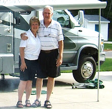
We had dinner and Ken went to pay for the site. As I did dishes there’s a knock on our door. “Hi”, says the man from next door, “could you take a picture for us?” They were having a birthday party. His name was Dale, and Lewis was having the birthday. Sure enough I took the picture and we were invited over for the evening. We met Dale’s wife Judy, and Janice, and Joel who belonged to Lewis. Really nice folks. We spent a great evening around the campfire getting to know each other. Dale & Judy are from Albuquerque. Dale invited us to join them for his birthday party the next night. Yes, these are real birthdays….
About 10pm we walked back to camp and called it a day.
Today was great.
Pictures: Along Seward Highway, Turnagain Arm, Beluga Point, Spencer Glacier
No comments:
Post a Comment