 Back on the road, more huge heaves all the way to Beaver Creek. Ken’s done a great job maneuvering us around, between, and over the heaves and dips. Along the highway we saw vent-like structures which are part of the Permafrost Research Project. They are testing special construction techniques designed to minimize the melting of the permafrost by allowing cold air to go through the road embankment and increasing the surface reflectivity. Based on the road we just drove they need to do more research!
We pulled into the village of Beaver Creek and stopped at Buckshot Betty’s located in the heart of town - ’don’t blink or you’ll miss it'. Don’t judge a ‘restaurant’ by its cover…this place was cute inside and breakfast was good They are known for having the “Best Bun‘s On The Highway“. (Cinnamon)
Beaver Creek is just a bus stop for folks on their way to/from Fairbanks. The town is 1 of 2 sites where Alaska Highway construction crews working from opposite directions connected the highway in October 1942. This was the first time vehicles could travel the entire length of the highway.
After breakfast we topped off our gas and headed for the border and Canadian customs. It’s very important when you are traveling here that you check where the next gas is available. The general rule is if you see a gas station top off! We had no problem going through customs. The highway enters Alaska’s broad interior plateau which extends from the Wrangell and Alaska Mountain Ranges to the Brooks Range beyond the Yukon River. This includes 730,000 acres forming the Tetlin Wildlife Refuge. It features rolling hills, marshes, hundreds of small lakes and 2 glacial rivers. The two rivers (Nabesna & Chisana) combine to form the Tanana River. This provides perfect habitat for Sandhill Cranes and Trumpeter Swans. The refuge provides home to other wildlife like moose, caribou, bear, wolf, fox, lynx, etc.
We stopped at the Tetlin National Wildlife Center and spent time on the viewing deck with telescopes searching for wildlife.. none except those roaming the deck! They offer an audio tour tape/CD for folks headed toward Tok which would give us history and information about our drive, however - the CD’s are all in Tok - eh.
This will be slow going today with lots of flagger stops. We are passing through stands of beautiful paper birch trees and the scenery just keeps getting better. Soon we cross over Beaver Creek which is tea colored due to tannins being absorbed as the water flows through the Muskeg. It’s very different than the clear blue and green glacial waters. The Tanana River is the larges tributary of the Yukon River.
The sky is getting dark and we can smell rain. A scenic viewpoint came up on our left and we pulled in to have lunch. Thunder started to sound in the distance, we could see lightning, and then the rains came! We enjoyed our lunch while the rain washed away a lot of the road dirt. While having lunch we planned our side trip to Chicken and Dawson City so we knew how many nights to keep the coach in Tok. Fortunately we had cell service so we booked cabins in both places. Now we are set for our next excursion.
The highway descends gradually as it follows the Tanana River Valley. The road seemed to get a little better as we pulled into Tok and found the Tok RV Village. We got set up, picked up bacon and bread for BLT’s and drove back to camp. We watched TV and called it a day. We have an early start tomorrow.
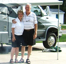
Pictures: Buckshot Betty's
No comments:
Post a Comment