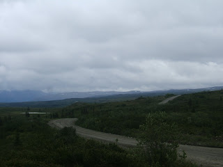


 Cloudy and showers as we start down the Denali Highway. This highly scenic road is very popular with many Alaskans. The 1st 3 miles are paved and then it turns to gravel. We stopped at the turnout for Joe Lake and enjoyed coffee and muffins as we enjoyed the tranquil scenery. It’s showering, but Ken threw a line in - no hits.
Unfortunately there are no views of the mountains as the clouds are to low but this is one of the most unspoiled areas in Interior Alaska. Further on we stopped at a turnout on the Nenana River which had a nice view. This is a favorite “put in” place for rafters. We noticed the clouds are lifting and we can see some of the magnificent Alaska Range. Next we stopped in a turn out with an interpretive sign on the highway explaining how the glaciers formed this whole landscape. We are traveling through 135 miles of alpine tundra and boreal forest while watching for Caribou. Everything is shiny after the rain and the sun is finally out.
The highway crossed over several creeks and we decided to fish our way up the right side and made notes for which creeks we’ll fish, on the left side, tomorrow on the way back. We took several small one track side roads that led to informal camp sites with great views. At mile 35 the landscape changes from forested terrain to alpine tundra covered with lots of blueberry bushes.
Taking another short side road we found a primitive campsite and fantastic views of Monahan Flats (pic glacier) and the Alaska Range (Mt Deborah, Hess Mountain and Mount Hayes to our right).
Further oin we pulled off the road at “the Knob” overlook (pic) with expansive views of valley, mountains, and the West Fork Glacier. There are many small kettle ponds and lakes dispersed all through the valley providing great habitat for moose, swans, and all types of water fowl. We passed several old lodges as we head east giving us a hint of the bygone days.
Soon we turned down a dirt trail we stopped for a snack at a lake (pic) with the Clearwater Mountains to our right. The main highway continues winding now through high bush along the side of the mountain. (side road pic) Soon the road descends into the Sustina River Valley which is a lush green. Glaciers have left their mark on this area. The road winds along the top of an esker, a sinuous ridge of silt, sand, gravel and cobbles deposited by a stream that flowed within the glacier. When the glacier melts away the deposits were left as long mounds. Eskers frequently are several miles long.
Along the side of the esker are many kettle lakes. As these glaciers receded they left behind blocks of slow melting ice which formed depressions called kettle holes or lakes. There were several pairs of wild swans floating along the shoreline. This area of the highway is so serene and untouched by humans.
As we drove over the bridge at Clearwater Creek we turned down an access road, pulled out the rods, and headed for the creek. It was fast water but we walked down the shore to where the creek met a small brook. Here there was a nice pool and we caught a couple of nice Grayling. (pci)
Back on the road we’re at mile 88 and winding our way through Crazy Notch. This is a long gap in the glacial moraine cut by a glacial stream that geologists think is 12-13 thousand years old.
We came across a side road on our left and somehow the jeep just turned . The road followed the McLaren River which led 14 miles to the Mclaren Glacier. It was 4 miles to the river and we drove across streams, over rocks and through mud. We probably got 3 miles in and came to really thick mud. We stopped to take pictures of the glacier and decided not to push our luck and turn around.
Back on the main road we continued east and drove over McLaren Summit (4086 ft) -(pcis)- This is the 2nd highest highway pass in Alaska but no drop offs and its gorgeous. We had some views of the Mount Hayes even though its cloudy. There are tons of little ORV (off road vehicle) trails here that lead out to small lakes, but most of them we can’t drive on with the jeep.
We came up over a ridge and into the high valley of the McLaren River. Below the plunging rim was the beautiful river running parrallel with the Amphiteatre Mountains. The light playing off the mountains was majestic. (pics) Glacier lake is visible between the gap.
Next we found ourselves in the Tangle Lake area which is popular with locals and has a great BLM campground on the round lake. Tangle is a series of lakes and you can canoe from one to the other with a few portages. We continued up the highway and passed several creeks and kettle lakes. We still haven’t seen any wildlife. Guess they don’t like the showery weather. Across the valleys we can see rain showers hanging over the mountains and the sun around them plays off the lake water. Its really spectacular to see the shades and images Mother Nature can create.
Soon we can see parts of Mt Wrangell about 78 air miles through the clouds. The mountain is 14,163 ft and is the northern most active volcano on the Pacific Rim. The landscape has turned to sweeping tundra with no trees and tons of blueberry bushes. I wish it were August so we could go berry picking!
Just before we enter Paxson there is a good view of the Alaska pipeline. We stopped at a turnout to view Summit Lake and the Gakona Glacier. This is still part of the 650 mile Alaska Range which extends across South Central Alaska.
We arrived in Paxson which sits at the east end of the Denali Highway. The Paxson Lodge sits on the corner of the highway and we had a reservation…Oh Oh it looks like it will fall down! In front of us is an old wood building with peeling paint, but not judging we got out and walked through the door… Nightmare! A room to the left was all broken up and we walked into a hallway with the bar on our left. Everyone turn and looked at us like ‘What do you want’. A guy said “can I help you?” “We have a reservation “, I replied. “Just go down the hall someone will be there” he directed. We found ourselves in a little restaurant and waited and waited. Finally a man came and advised his wife was fixing up the room it wasn’t ready. Seems like they were full last night with a group of birders. The place is disorganized and grungy but we sat in the restaurant area and ½ hour later the man was back to tell us the room should be ready soon. We looked at the menu… eh! I went outside and grabbed the Milepost out of the car to find another place. I found the Tangle Inn and made a call. They had one room left. Sold!
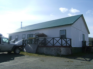
After waiting 45 minutes we quickly picked up our things and left. Back up the road about 20 miles we pulled into the Tangle Inn which we had passed earlier. A very cute little lodge overlooking the lake . Inside the office and restaurant was very rustic and cozy. Naidine gave us a room in the white building to the back which looked like a bunkhouse. “Just go right and you’ll find ‘Moose 2”, she says. The room was clean and comfy. We walked over to the restaurant for dinner and found a wonderful Turkey Dinner buffet with all the fixin’s. Sammi was our server and she was terrific. The Johnson’s have owned the inn for 34 years. A large group came in and sat at a long table next to us… yep it was the group of birders from the other place. Seems the Tangle Inn is well known by hunters and fishermen in the area and is very popular year round.
We hit the sack and were very thankful the inn had - had a cancellation!
Pictures: The Knob & West Fork Glacier, Crazy Notch, Clearwater Creek, Clearwater Wayside Bridge, Clearwater Creek Grayling Fishing (3), Riding a top an Esker, Pot Hole Lake, McLaren River Road, McLaren Glacier, McLaren Summit, River Valley and Mt Hayes, Rain showers over High Valley, Along the Road, Amphitheater Mtns and Glacier Lake, Glacier pulloff, Our Bunkhouse at Tangle Lake

No comments:
Post a Comment