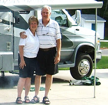


 Another gorgeous sunny morning as we headed into town for breakfast at the Bamboo Room. It’s a little local place and the food was good. We’re excited as we leave Oceanside and stop at the Duck In RV and Car Wash just outside of town. With both vehicles clean and gassed up we hit the road at 10:30am.
Driving the Haines Highway, one of North America’s most scenic highways, we enter the Chilkat Bald Eagle Preserve. The preserve was established in 1982, and the 48,000 acres is the seasonal home to more than 3,000 bald eagles. We’ve seen several eagles and one nest along the river. The eagles return to the same nest every year and add to them. Some nests can be up to 7 feet across. They have their fledglings in April.
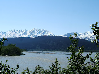
The road parallels the glacial silt green Chilkat River with magnificent views of the Takhinsa Mountains across the river to our southwest. We stopped at a viewing area to walk the river flats looking for eagles. On the way back we met some folks who were viewing Mountain Goats up on a high mountain ridge across the road with a scope. The let us look and we could see 7 Mountain Goats with babies.
The Chilkat River turned east and we followed the Klehini River northward passing the Saksaia and Jarvis Glaciers on our left. The scenery is fantastic and that’s what we’ll see the most of today!
Arriving at Pleasant Camp, Canadian customs, we had no problems, but we had to ‘abandon’ the personal pepper spray we had on board. The officer explained we could carry bear spray and cross the border. We are in British Columbia now and after crossing 5 Mile Creek we start to climb into a glacial area and the landscape changes from river valleys and forest to glacial alpine tundra with spectacular snow covered mountains. With the elevation rising we arrive at the south end of Three Guardsman Lake which is breath-taking. Three Guardsman Mountain (6300 ft) rises directly behind the lake. We kept saying - how do we describe this! - we can’t. We descend only to start another climb. Crossing Stonehouse Creek we can see the highway rising in front of us. Reaching the top of Chilkat Pass (3439 ft), its very windy, and everything is covered in snow and sparkles in the sunlight.
We stopped at Historic Milepost 48 at a gorgeous turnout on the Haines Highway Summit (3510 ft) and read the history of the highway. Part of the highway was originally a ’grease trail’ used by the coastal Chilkat Indians trading oil for furs from the Interior. In the 1880’s Jack Dalton, explorer and entrepreneur, developed a packhorse trail to the Klondike goldfields along the old trading route. The present road was built in 1943.
The highway travels between the sapphire blue Twin Lakes (one on each side of the highway) and enters the Tatshenshini-Alesk Wilderness Provincial Park where we stopped in a large pullout for lunch. The ice fields visible to the west are the largest in the world outside the polar ice caps. We are high on a hill looking down over the Tatshenshini River valley and alpine tundra. This is definitely grizzly country. The river is a big rafting area in the summer, but we can still see snowmobile tracks in the snow running up and down the foothills. There was a car at the end of the pullout with what looked like the hood up, so Ken strolled over to see if the man needed help. Nope it was the “Grizzly Man”. He’s local and comes up here to track and locate bear to hunt. He had all his gear and weapons in his little car. He told Ken he hikes miles into the woods and along the river and has already caught 2 bear this year. Ken found him very interesting. Once Ken came back to the coach we had lunch just watching nature!
After lunch we continued on and came to the Yukon border in Canada. This was exciting - we never dreamed we would be in the Yukon. We laughed remembering the 50’s TV show when we were kids 'Sergeant Preston of the Yukon'.
We are in the Kluane National Park now with the majestic St Elias Mountains on our left. As we ambled down the highway Ken saw two moose in a marsh. Along the way we passed the turnoff for the Klukshu Fish Camp. We kept going as we weren't sure how good the dirt road was down to the camp. This is the last working Fish Camp Klukshu left from the gold rush days. There are wooden fish traps and smoke houses. Members of the village still work this village every summer.
Our stop for today is Lake Dezadeash (Dezi-ash) Yukon Government Park. We found a site right on a point on the lakeshore. It's beautiful and breezy which keeps the bugs down. Hoping to put the boat in we checked the boat ramp, but it's too windy and rough with lots of white caps. A nice beach is directly behind the site and we put our chairs out and enjoyed the views and lapping waves on the lake. There is no one here and its great. Ken spotted 2 white forms across the lake, with the binoculars we could see they were Trumpeter Swans! They were gorgeous and huge!
When the sun went in it got cold and very windy. We didn't have a fire - to dry and no rain. We had dinner, played Scrabble and went to bed listening to the wind and waves on the lake.
Great day!
Pictures:Chilkat River Flats (2), Chilkat Eagle Preserve, Saksaia Glacier, 3 Guardsman Mountains (2), Climbing Chilkat Pass, Chilkat Pass Summit, Entering the Yukon, Tatshenshini River Valley lunch spot,1st View of Lake Dezadeash, Our site on Lake Dezadeash, Relaxing lake view

No comments:
Post a Comment