Friday, July 31, 2009

Pitchfork Fondue Anyone?

Sadly left the North Unit this morning in showers and clouds. We really enjoyed this stop and highly recommend it. We are in Mountain Time now as we rolled down Rte 85S down to I94W. We try to stay off the interstates but in some areas the routes meld together. The Painted Canyon Visitor Center sits on the upper margin of the badlands. Walking the trail along the canyon rim where we had a picnic lunch we were treated to a panorama of the broken topography and it's colorful hues. The colors in the canyon walls mixed with the dark green trees and flowing grasslands are terrific. It is so hard to capture it all in pictures.

We arrived at the Red Trail Campground in Medora, ND mid afternoon. This came highly recommended by the folks we met at Fort Totten. It was OK, we got a nice site on the end by the entrance. The campground is very convenient and close to town. Medora is a very historic town with lots to do. The town was founded in April 1883 by a French nobleman, the Marquis de Mores. He named the town for his bride who was the daughter of a wealthy New York City Banker. Prior to the Marquis's arrival the area had been a hunting ground for Native Americans, the site of The Battle of the Badlands in 1864 where the military fought the Sioux. General Georg Custer also passed through in 1876 on his fatal march west to Little Bighorn. When the Marquis arrived he founded the town and built a meat packing plant, hotel, stores, and a large Chateau . Although he was a visionary he returned to France 10 years later in Financial ruin. Understanding this history it was now time for us to go exploring.

Everyone we talked to recommended 2 things here... the Pitchfork Fondue and the Medora Musical. The musical was recognized as one of the 2009 top events in North America, but we've seen so many of these shows in our travels we decided to pass on it this time. We purchased our tickets for thePitchfork Fondue and headed into the historic area. First stop was the North Dakota Cowboy Hall of Fame. This explores the history of Native Americans, ranching, rodeo, and the western lifestyle of the northern plains horse culture and the badlands. There was a new display on the 2009 National Finals Rodeo Cowboys which was really interesting. After all that history we were thirsty and in a cowboy town where else would you go... The Rough Riders Hotel! Built in 1885 the hotel has always been the center of activity in Medora where visitors arrived by car and on horseback. We mosey'd up to the bar and felt like we had stepped back in time.

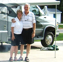
With our thirst quenched - it's now dinner time. We pulled into the corral of the Pitchfork Steak Fondue. Every night the cowboys load ribeye steaks onto pitchforks and fondue them western style. We found a spot at a long table and savored our steak as we loverlooked the picturesque badlands from atop a bluff at the Tjaden Terrace. The steak came with all the fixin's and new friends. We met a nice couple (Bill and Margaret) from Pheonix. After dinner we went back to camp. Being close to town we discovered that the local train goes through town several times a night. t sounded like it was coming right through the coach! We are learning that campgrounds and railroads seem to go together! It was a nice night.

Thursday, July 30, 2009

North Unit - More Pictures


Here are some more pictures we took in the North Unit....

* Stone building overlooking Missouri River
*Scenic views of park
*Bison grazing grasslands in park
*Deer aren't afraid

Theodore Roosevelt North Unit


Woke up to very black and threatening clouds. It's going to be another scortcher! We enjoyed the historical sites we visited, but Williston was disappointing. Still following the Lewis & Clark Trail (Rte 85 S) we are excited as we are getting closer to the Theodore Roosevelt National Park. Coming down the winding road into a valley we spotted a beautiful bridge in front of us. As we approached we found it was the Lewis & Clark Bridge crossing the Missouri River. With limestone buttes in the distance the road leads us up the hills into a wildlife management area. The scenery is changing again. The rolling hills are dotted with small trees, sage, many large limestone buttes. Eventually the buttes began blending into the majestic colored walls of the badlands.

We pulled into the Thodore Roosevelt National Park North Unit to find our tax dollars at work. They were doing road work in the park so we followed the pilot car down the rutted dirt road from the park entrance for about 5 miles. As we pulled into the Juniper Campground we can see the beginning of the badlands and the limestone formations. They are just awesome.

This is a "primitive" campground and the sites were beautiful. No water or electric hookups, but we are self sufficient and surrounded by natural beauty. The campground is circular with the campsites around the edges and an open area in the middle. Our campsite was a pull through and is bordered by forest with a nice view of the open area. It's in the mid 90's today, so we got set up and then relaxed at camp. Time for a walk so we decided to check out the Little Missouri river which flowed around the campground. Along the river bed we could see where animals come frequently including bison whose tracks you can't miss. We cooked dinner and while eating at the picnic table a Mule Deer walked right through the trees in front of us about 30 feet away. We watched him and he finally ambled off..it was great!

The park was originally established as Theodore Roosevelt National Memorial Park on April 25, 1947, to honor our 26th president and to preserve a portion of the scnic North Dakota badlands. An Act of Congress in 1978 changed the name to Theodore Roosevelt National Park. It was here that Roosevelt rebuilt his health and life after a series of personal losses, including the deaths of his wife and mother. He remarked that he never would have become president if not for his time ranching in North Dakota. During his time in office, President Roosevelt set aside 230 million acres of public land in national monuments, national parks, wildlife refuges and forest reserves. Thank goodness for his foresight, without it I'm sure we would not be able to ejoy the beauty today!

After dinner we drove the 13.5 scenic drive that winds through the North Unit of the park. We left the campground about 7PM hoping this would be good wildlife viewing time. Across from the entrance are formations of rock that look like cannon balls sitting on pedestals. Down the drive we stopped at a pull out and walked part of the Camprock Coulee Trail. We walked along the floor of the dry water gulch and admired the fantastically broken rock formations. Walking through the coulee we saw a mule deer and then jumped a little pronghorn. Unfortunately we didn't have the camera with us. It is still really hot and sunny and we weren't prepared for a long hike so we went back to the car. Further up the road we saw the first herd of bison across a grass field and caught sight of the elusive big horn sheep on a precipice to our left. Continuing on we saw more deer and a doe with a fawn. There was a little hiking trail that led along a ridge with a stone building out on a ledge. The shelter at River Bend Overlook was built by the Conservation Corp and has spectacular panoramic vistas in every direction. At the end of the road we came to the Oxbow Overlook and were watching a deer in the gullies below. When I looked to the right about 10 feet away a huge bison was sauntering up the hiking path just to our right! We slowly backed away and cautiously got back to the car where we grabbed the camera in time to see our bison come off the trail and into the meadow a few yards in front of us "grunting" and eating. Wow! We watched him and continued back down the road to camp. We saw more deer and one posed for a picture... We are getting closer to camp and came around a corner and there was bison beside us on the side of the road! We pulled up carfully and got a photo and moved on quickly. They snort and grunt and are HUGE! As we approached the little bridge leading to the campground a herd of bison are coming towards us on the road. There are "baby" bison in the group and the adults are very protective. They kept coming towards us across the bridge and then just before the car they turned onto a path to our right.... right into the campground!! After they all crossed we pulled into the entrance. There were approximately 100 bison roaming all over the picnic area and roadway. Awesome!

We made our way carefully back to our campsite and talked about all the great things we saw today. We can't wait for tomorrow!

Wednesday, July 29, 2009

Two Mighty Rivers


We crossed the 4 Bears Bridge and headed down the Lewis & Clark 1804 Trail and into New Town where we stopped for breakfast. We stopped at the Super Value grocery. Every little town grocery is a new adventure and we never know what we'll be able to get. We put together a grocery list and it's fun to see how much of it we can get. This morning was cloudy and we followed Lake Sakakawea through a varying landscapes of fields, rolling hills of grass and sage, and strange looking buttes. Our end point today is Williston, ND which from the brochure looks like it has a lot to do.

We got into Williston and found the Buffalo Trails Campground. There is a municipal park down the street and we checked it out. There were picnic areas but no place to launch the boat or canoe. We were going to stay at the Lewis & Clark State Park but it was so far out of town we decided on something closer to the attractions. The campground is awful, but we are here for 2 nights. We'll use it for a base camp to see some of the attractions in the area. It was disappointing as there was no canoeing nearby and the golf courses are way overpriced!

After getting set up we drove down the 1804 Trail to the Missouri-Yellowstone Confluence Center. The center overlooks where the 2 rivers merge. The confluence is an area Meriwether Lewis referred to in his journals as "this long wished for spot." It is an area with magnificent views. In the center we watched a video "Splendid Isolation:Ft Buford. Ft Buford was one of a number of military posts established to protect overland and river routes used by immigrants settling the West. It served as the sentinel on the northern plains for 29 years, but is best rememberd as the place where the famous Hunkpapa Sioux leader, Sitting Bull, turned over his rifle in 1881. The center had a patio with a bunch of birdfeeders and we watched for a while. We saw a Black Headed Grosbeak and a Spotted Towhee which we don't have at home. The Goldfinches were every where. The rain stopped and we took a walk along the river. You can see the water from these two mighty rivers converging from different directions and then they swirl together and continue on as the Missouri. We went down to the boat ramp to see if we could launch the fold cat but the water was really fast due to the rain.

We drove up the road to the Fort Union Trading Post. The trading post was built near the confluence in 1828 by John Jacob Astor's American fur Company. It dominated the fur trade on the upper Missouri River until 1867. It was the headquarters for trading with the Cree, Crow, Blackfeet, Ojibwa, Hidatsa, Mandan and Arikara Indians. The fort is set up with indian tepees around the outside of the fort walls and you can really get a feel for what it was like back in the 1800's.

We did a lot of driving today and decided to try the Italian restaurant just down the street from camp at the Eagle Ridge Golf course. Food was ok, but we miss our good Italian food. We thought we might play golf in the morning if the weather clears. The sky is pretty black and it's really hot and humid. We had a thunderstorm and small hale tonight. We are trying to decide what to do tomorrow..


Tuesday, July 28, 2009

Kildeer Mountain Byway


Before leaving Pick City we found a car/truck wash in "downtown". Ken washed the vehicles and I went for coffee. It's really hard to get all the grasshoppers off the bumpers and grills. Driving up the Lewis & Clark Trail of 1806. The park ranger said this would be a nicer drive than just Rte 200. This route will take us through the Kildeer Mountains.

We stopped at a turnout in an area where they were mining Lignite Coal. From Thomas Jefferson's wish to determine the presence of "pit" coal until today. We were standing in the heart of the Coteau Properties Freedom Mine, America's largest Lignite coal mine. Producing over 15 million tons a year. This mine provides boiler fuel to generate electricity and also converts to synthetic natural gas for millions of Americans across the Northern Great Plains and Upper Midwest.

We passed waves of grain and saw our first herd of Bison in a wildlife management area. We stopped at the Crossroads Cafe at the intersection of Rte 22N and Rte 8 for lunch in Kildeer. We had Knoelph Soup (potato dumpling) for lunch. After lunch we turned onto Rte 22N known as the Kildeer Mountain Four Bear Scenic Byway. This drive runs from Manning ND along the Kildeer Mountains and then to Crow Flies High Butte just east of New Town. The ranger told us there was a beautiful new bridge leading into New Town called the 4 Bears Bridge. We are going through our first mountains. They are lush green and have flatter tops rather than pointed peaks. We see small oil wells in many of the fields along the road. The landscape is absolutely beautiful and very different from what we are used to. We came up a hill into New Town and found the 4 Bears Casino at the top of the hill and just before the bridge. There was a little RV park in the back but no sites available. However, you could camp anywhere so we pulled up a piece of grass by some bushes and parked. We have a great view of Lake Sakakawea and the new bridge. Naturally we went in to check out the casino and then came back to camp. We made dinner and it began to rain. We are only here for the night.


Monday, July 27, 2009

Day At Camp

It's really hot today. We spent the morning looking at maps and planning. We weent for a hike down the grass trail around the lake and sat for a while on the beach. The rest of the day was spent hanging out at camp and working on the blog. The wind came up this afternoon and there were 2-3 foot waves on the lake! Ken tried to make friends with a 13 lined ground squirrel that was running around the site. The little guy didn't want to cooperate. After dinner we went for a bike ride around the park. Most everyone left yesterday so the park is really quiet, there is no one around us.

Wasn't a real exciting day but was nice. We are off tomorrow....

Sunday, July 26, 2009

Fort Mandan - Part 2


On to Fort Mandan where we took a tour and then on to the Lewis & Clark Interpretive Center. The fort represents a replica of the place where the expedition spent the winter of 1804. It amazes me how these people could live through a cold winter in such basic buildings. The Interpretive Center had great historical presentations about the exploration and art by a local artist. When you go through the forts you can feel the history all around you, it's really special.

Back at camp we relaxed and had dinner. We went for a bike ride around the park again. Alot of the weekend people have left now and the park is pretty empty. As we came up one of the park roads we spotted a Coach House parked up the road from us. It was the same one we saw in Rugby yesterday. We stopped and introduced ourselves. Larry & Marge were from Florida and had just bought the coach. We talked for a while and then went home.

The town we are in is Pick City, ND. There isn't much here, but they have a great car wash where we can get the coach and car washed. (It needs it!)

We covered a lot of miles today and we sat outside and talked about the things we saw today. Today was a really good day and we had a lot of fun.

Knife River Indian Villages - Part 1


Today will be a full day. This morning we head down the Sakakawea (Sac-ka-ga-weigh-a) Scenic Bypass. (Rte 200A). Our first stop was the Knife River Indian Village. The village had become an important trading site by the ealy 1800's. It was in one of these villages that Sakakawea lived with the Hidatsa clan. It was when her husband, Toussaint Charbonneau, was hired as Lewis and Clark's interpreter, that Sakakawea became part of the expedition. Today they were having a cultural festival and both the Hidatsa and Arikara clans were represented. We talked with a grandmother who still follows the "old" ways, while her grandson attends Yale! (Quite a contrast). There were various tents set up and we learned how to make a bow, watched a lady making quill jewelry and Ken played some Indian skill games. The best part was going into the reconstructed Earth Lodge. In the visitor center we watched a video about a woman who grew up in this clan. It was really interesting.

Passing more hay fields we sauntered down scenic Rte 200A to Washburn. We stopped at Cross Ranch State Park so we could canoe the Missouri River. There were no guides available so we couldn't take a canoe. We checked out the boat ramp to see if we could put the fold cat in, but the flow of the river was really fast. We had to experience the Missouri so I stood in the river!

On to Fort Mandan where we took a tour and then on to the Lewis & Clark Interpretive Center. (see part 2)

Saturday, July 25, 2009

What is "Rapeseed"? July 25 - part 1


Rolling out of Carrington up Rte 200 W. We turned onto Rte 1804 which is the trail Lewis & Clark took when President Jefferson sent them to explore the Pacific Northwest. President Jefferson told US Army Captain Meriwether Lewis
The object of your mission is to explore the Missouri River, and principal streams to determine if the waters of the Pacific Ocean and the waters of the Columbia, Oregon, Colorado or any other river may offer the most direct and practicable water to allow the crossing of the continent for the purposes of commerce.


Lewis chose William Clark as his partner and they began preparations in 1803-1804. There's a lot of history on this trail and we hope to visit many of the historical sites.

We are definitely in the "Heartland"! There are hay fields as far as the eye can see. Tons of bugs are making a pretty big mess on the windshield. We saw a woman standing on the hood of her truck with a mop cleaning her windshield! Ours isn't much better...

Talking to local folks we found out what the yellow flowered crop was that we have been seeing. It is "rapeseed". I thought they were teasing us, but it's true. We know it better as Canola. In agriculture, canola are certain varieties of oilseed rape, or the oil produced from those varieties. Canola is a trademarked hybrid of rape initially bred in Canada. Rape Seed Oil was produced in the 19th century as a source of a lubricant for steam engines, and the oil has a bitter taste due to high levels of acids. Canola has been bred to reduce the amount of acid, yielding a palatable oil. Canola was derived from Canadian Oilseed Low Acid.

Later this morning we came across fields of golden grain and "Flax". From the road Flax looks like a lake of periwinkle blue. These fields are absolutely magnificent!

We passed through McCluskey, ND which is the geographic center of North Dakota. Every day gets more spectacular and has something new to make us realize how beautiful this country is!

The landscape started to change this afternoon. A lot of hills, more cattle, rocks in the fields. We have a new game now... we "honk" at the cattle and they raise their heads and look at us (to say HI)! All of a sudden there is a herd of about 15 steers coming down the side of the road toward us (escaped from some where). We passed through Underwood ND which as a large coal mining operation.


Garrison Dam & Powerhouse - July 25 - part 2


About mid afternoon we pulled into Lake Sakakawea State Park. The state park is awesome and sits on the shore of Lake Sakakawea. The lake is a reservoir in the Missouri river basin in central North Dakota. Named for the Shoshone-Hidatsa woman Sakakawea, it is the third largest man-made lake in the US, after Lake Mead and Lake Powell. We have a great view of the lake from our site. There is a little Cantina in the park and we had lunch there. Homemade food! Baked Beans, ham,and real mashed potatoes which we split.

Off for a tour of the Garrison Dam Power Plant. The last tour for the week was at 3pm and we made it. We had never been through a power plant before. The Garrison plant began in 1947 and was completed in 1954 at a cost of about 300 million dollars. It is the 5th largest earthen dam structure in the US. First we saw the turbines (7 feet hight, 18 feet in diameter). Next came the generator room with the 5 generators and then the penstocks which carry water from the Intake Structure to the case around the turbine. The diameter is 24 feet and length is 1650 feet and you feel like a dwarf standing next to them. Garrison is a multi-purpose project providing for hydroelectric power production, irrigation, flood damage reduction, navigation, fish and wildlife, municipal and industrial water supply. It was really interesting.

Back to camp for dinner and then went for a bike ride around the park. We saw 2 mule deer feeding along the tree line. Riding up to a point overlooking the lake and boat ramp we sat at a picnic table and enjoyed the view. We hope to put our boat in on Monday. We rode back to camp and relaxed in our chairs watching the sun set over the lake.

We did a lot today so we broke it into two parts so we could also get more pictures in ....

Friday, July 24, 2009

Down the "Old West Trail"


Woke up to 20 mph winds this morning. Today is the first day of the Cabela's Masters Walley circuit championships which brings professional fishermen from all over the country. The bass boats are awesome. They fly around the stumps and through the white caps from one end of the lake to the other. After breakfast at the local Family Inn Restaurant we went back to the coach to plan the next part of our trip.

About 1pm we wandered over to the service area and I saw Neil walking around with a box and I said to Ken "I bet that's our part!" and it was...They took the coach in to work on it and we took off for another adventure around the lake. We went to the Woodland Resort on the lake for lunch. We sat on the patio and watched the bass boats race up and down. We went back to the dealer after lunch and the coach was ready! I can't say enough about the guys and the service we had they were fantastic.

At 3:51 pm we left the parking lot and headed down the Old West Trail (Rte 281 S) to Carrington, ND. We crossed the Continental Divide at 1,619 feet above sea level. Carrington is the first stop in our new route. Carrington is known for manufacturing pasta. We wanted to go through the manufacturing plant, but unfortunately we found out they only give tours to groups with previous arrangements.. Oh well...We found the Carrington City Park in our "Free" Camping book. It's a really pretty city park and has 8 sites with water & electric hookups and is walking distance to town. We cooked sausage & peppers for dinner and walked to the ice cream shop for malts!

It's good to be on the road again.


Thursday, July 23, 2009

Geographic Center of North America


Stopped by the service department and they told us the part was "emergency' ordered. it could be in tomorrow around noon. If not it could be Monday or Tuesday (eh).
After 2 days in the parking lot, a day at the state park (and showers) were called for! It was nice to spend the morning here and enjoy the lake. We read the paper and did some trip planning to change our route to follow the Lewis 7 Clark trails.

About noon we took off for Rugby,ND to see the Geographic Center of North America. We got to Rugby and couldn't find the center, so we stopped at the tourist info center. We asked the lady and she walked to the windo and pointed to a stone monument at then end of a parking lot across the street. We decided to take a ride around Rugby and then come back to the monument. On our way through town we saw another Coach House! We didn't have a chance to talk with them, so we went back to the monument. We took pictures and laughed about being such "tourists". We took Rte 2 back to Devil's Lake. There really isn't anything of interest on this road and it convinced us to change our trip plan. The folks we met at Fort Totten told us about the North Dakota Passport which is a travelers guide. We picked one up and it will help us along the way.

Back at camp we relaxed (in the lot) and then went to the Spirit Lake Casino for the diner buffet. The food was good...gambling was bad... The casino sits up on a hill over the lake and we watched the sunset - it was great!

Hope there is good news tomorrow..

Wednesday, July 22, 2009

Devils Lake - A Real Discovery


Well the service guys can't get to us until about noon, so we went exploring. After a stop at the visitor center we found out a lot about the area. North Dakota was ranked the friendliest state in the U.S. just recently and Devils Lake is proof. It is a friendly city and an inexpensive vacation destination. Devils lake is the largest natural body of water in North Dakota (who knew North Dakota had lakes) and is prime for all types of sports.

We took a ride down Rte 19 that goes around the lake. It is very different - almost like driving on a causeway and then you have fields on both side of the road and then back along the lakeshore. The lake is strange as it has groves of dead trees sticking out of the water (very erie), then there are marshy areas and then open water again. It was really unique and beautiful in it's own way. We continued down the road and found the Graham Island State Park. We didn't go in the park, but may come back if we have to stay longer. We continued around the lake and onto Rte 281 S. We saw signs for Fort Totten and decided to go take a tour.

Fort Totten is a great place. It was constructed as a military post, became an Indian boarding school, Indian health care facility, and a reservation school. The fort served American Indian policy from 1867-1959. Initially, the fort policed the surrounding reservation. The soldiers enforced the peace, guarded overland transportation routes. It was decommissioned in December 1890. In 1891 the former post became an Indian boarding school and operated until 1959. In 1960 it became a historic site. Today the fort includes seventeen historic buildings which date from 1868-1871. One of the buildings has been adapted as the Totten Trail Inn bed and breakfast. This is a beautiful place with several nice rooms and would be a great place to stay.
We met a group of RVers from North Dakota who invited us to join their tour group. They gave us a lot of information on things to see and do in this state. They suggested we alter our route to go further south and follow the Lewis and Clark Trails. We are going to look into it further.

We left Ft Totten and onto Rte 57 heading back to the coach. We passed a wildlife preserve and casino. We will go to the preserve after dinner when it cools off. It's very humid, in the high 80's and still windy. We will have more chance to see animals at dusk.

We got back and Ken checked with the service guys. They couldn't find a problem when they test drove the coach so Ken went out with Neil. He showed them the problem and they agreed to order a new Master Cylinder after talking with the service manager. However, they have to find one and have it shipped in. It could be Friday or possibly Monday or Tuesday. Looks like we may be living in the parking lot for the weekend. We have decided we won't leave until we are comfortable with the brakes. It's not too bad, the flood lights a little bright, but it's all part of the adventure....
Dinner tonight was a place called the Pizza Ranch (a pizza buffet - eh). Never seen one of these before. Probably won't do another one.....
The Sully Hill National Game Preserve was established in 1904 when Teddy Roosevelt expanded the nation's park system. It is one of only two big game preserves in the United States. Over 60,000 visitors come to visit each year to see it's bison, elk, deer, and black tailed prairie dogs. We followed the driving route through the park with various overlooks. We saw seven whitetail deer as we drove through the meadow areas but no elk or bison. We stopped at the Praire Dog Town and watched the Black Tailed Praire Dogs. They are really funny to watch. We continued down the road and came into a marsh area and saw several deer, we sat quietly and turned off the car. Eventually we saw 4 large elk come out of the trees across the marsh. They were feeding along the edge and moved slowly toward us. Then a group of mule deer across the road to our left with one buck with small antlers passed by us. It was getting dusk and the sun was pretty much set. All of a sudden in front of us to the right from behind a fallen tree comes the largest male elk I've ever seen with a huge rack (10 points). He was awesome! We took pictures but it was pretty dark. All of the elk eventually crossed the road to a pond at the entrance of the park. It's dark now and hard to see, so we left the park. It was a great night and a real treat to see these beautiful animals in their natural habitat.

It was a good day and Devils Lake has become a pleasant surprise.

Tuesday, July 21, 2009

Uh OHHHHH


Headed up Rte 59 N to Rte 1 W on our way to Rugby,North Dakota. Rugby is our interim stop on our way across North Dakota to Teddy Roosevelt National Park. It's sunny and hot as we crossed into North Dakota at 11:26AM. This is our 9th state!

We are out of the flat country and into rolling hills with fields of hay, grain, corn (still not very tall) and a crop that has bright yellow flowers and is a gorgeous contrast to the other lush green crops along the road. The wind is getting stronger as we turn onto Rte 17 W and we had to pump the air ride up to 70 for a more rigid ride. We crossed over the Red River North this morning. You can see for miles on the plains. It's like being able to see where you're going before you get there. If you close your eyes and picture open flat fields of lush green and bright yellow and then all of a sudden there is a huge grove of trees. As you get closer you can see flowers and gardens surrounding a farmhouse and barns. It's like an oasis!

We were breezing down Rte 17 enjoying the open farm land and getting ready to turn onto Rte 20 which is a fairly main highway. Ken started to slow down and when he stepped on the brakes there was nothing..... Fortunately we had already started to coast to a stop. We had little choice as we rolled towards the stop sign. The car in front of us had made the turn, and there were no cars coming down the highway and we were able to roll through the intersection. We had two choices - roll up a narrow dirt road or into the drive of a deserted building. We chose the second as the driveway had an outlet back to the main road. We checked and found no leaks, we called Ford and they found a Ford dealer 20 miles away in Devils Lake (great name). Ken found he had some brakes when he pumped them, so we unhooked the car and limped slowly to the Ford dealer. The dealer couldn't check the coach until tomorrow and suggested we might want to find a campground. We said no we weren't going to take a chance and drive the coach with faulty brakes. They were nice enough to let us stay in their parking lot for the night.

Atleast there are restaurants in the area and WalMart right next door. We went to a restaurant called Felix - was OK - but the waitress didn't know Merlot was a wine when I ordered - very scary! We drove around town and then went back to the coach. We have to wait to see long we may be here. We hope they can fix the brakes as they don't have a lift - then we will have to think of something else! Atleast this is some what of a resort area with a big lake, so there is some hope - I think....


Monday, July 20, 2009

Arctic Cat Day

It's sunny and getting very humid here. After breakfast we went to find the Arctic Cat Plant. We stayed in the parking lot and worked on the Blog and e-mail until it was time for the tour. About 12:45 several RV's pulled into the plant parking lot. They were here for tours also and they came from Texas, Illinois,and Alaska.

We started through the plant at 1PM. They were making Bear Cats and ATV's today on the line. It was interesting to see the frames hanging from the ceiling on a conveyer belt that moves them through the paint area and various stations. They attach the handlebars, hoods, seats, and coverings as they move down the line. We watched the quality control area for the ATV's and watched them run it through a check before driving it onto a platform for packaging. Being a snowmobile family this was very interesting. Unfortunately they would not let us take pictures in the plant.

Went back to the casino and then watched TV and got ready to move out tomorrow.

Sunday, July 19, 2009

Just a Travel Day

Had a nice ride along Leech Lake as we headed up Rte 371 N out of Walker. Leech Lake is a really pretty resort area. The landscape has changed from the lakes and forests to farm land. The corn is getting bigger and if it's not corn it's hay. The farms are very picturesque. We stopped at a farm stand and got some fresh vegetables for dinner tonight.

We got to the Seven Clans Casino in Thief River Falls. We have our tour tomorrow and then will be heading for the Dakotas. Our site here is out in the dirt parking lot but it's ok (what do you want for free?).

Took a quick drive around town. It is fairly good size and has a really nice park downtown along a river. Back to camp, watched TV, and called it a day.

Saturday, July 18, 2009

Casino Hopping

On our way to Walker, Minnesota. Why you ask... because it is half way to Thief River Falls and our Arctic Cat Manufacturing Tour. Ken has been an Arctic Cat Snowmobile fan since the 70's so we had to put it on our itenerary. Also there is a casino in Walker. We found this great site - Casino Camping.com - and it shows the casinos with free camping. We are casino hopping now! The casino in Walker has RV parking with electric hookups "if it's free it's for me" says Ken. We pulled into the casino and got set up. Went inside and played for a while and then Ken went back to the RV. When I got back the 2 couples in the RV next door came over with a great bean salsa and chips. Ken had been talking with them earlier and they wanted to see the coach. We were all sitting around when the security golf cart pulls up and Miriam the security guard joined us. "I had to see the inside of your RV. It's great." she said. We had a fun visit. Later we went back to the casino for the buffet dinner.

Walker claims to be the Muskie Capital of the World! We won't find out, but we had fun and met some really nice folks.

Friday, July 17, 2009

What Was I Thinking???


Off to the Mall of America! Don't ask me why, everyone told us we had to see it. We were told it was an hours drive...well... try two hours with heavy traffic and construction. Finally we got there and guess what - it is a huge Mall! I guess if you are a shopper it would take 2-3 days to cover all the nooks and crannies in the 3 stories. Of course for the shopper it is a "Mecca". For us the attraction was the indoor amusement park and the novelty of it. The park takes up all 3 stories and is Six Flags squished into one small space. It does have floor to roof rollercoasters and lots of rides for the kids. There are other attractions like the Underwater Adventures Aquarium, LEGO, and theatres. Think of this as a day park and the admission to the various venues are about the same! There are some good restaurants sprinkled around the mall, so we grabbed lunch sitting on the balcony watching the kids ride water coaster. Oh yes, across the street there is an indoor waterpark (we didn't go).

Time for us to move on. Back in the car we left for the city of St Paul (more traffic) and a river boat ride on the Mississippi. Naturally it is very cold and windy today but we had to do it! The boat takes you through part of the Great River National Park, which has a great habitat for blue herons, hawks, peregrine falcons, and bald eagles. The captain gave us some history of the area and how river boats played a big part in the development of the towns along the river. We sat up on the top of the paddlewheeler (outside) by ourselves. Everyone else was inside, so they missed the bald eagle that was sitting up in the branches of a dead tree along the shore. (Look at the third dead branch on the right side of the tree near the V and you can just barely see him. ) It was a nice ride.

We arrived back at camp to find it full. We went to sit outside and there were people walking back and forth through our site. All of a sudden there were announcements coming out of a loud speaker explaining the rules for the weekend! So much for relaxing. Thank goodness we are heading back to the wilderness tomorrow!