Wednesday, June 30, 2010

Ring of Fire


Woke up to sun! Ken did laundry and I washed the floor and blogged. It was cool and windy on the bluff but with the screen door open inside was cozy with a great view across the Inlet. I kept checking the mountains across the Inlet, but unfortunately they are still hard to see.

The mountains are part of what is known as the ‘Ring of Fire’. Within the north-south spine of the Chigmit Mountains are five active peaks. Mount Spurr, 11,070 ft, last erupted in 1992, Mount Redoubt is part of this chain, and directly across from the campground is Mount Iliamna, 10,016 ft surrounded by glaciers. Mount Augustine and Mount Douglas complete this eruptive chain. We do hope we’ll have a clear day so we can see them.

Ken & our neighbor Mike decided to go to Centennial Park fishing, This gave us each a day to ourselves. I did some reading and finally finished the first book in the Twilight Saga. It was good and I could visualize the area because we traveled through Forks, Washington on our way to Alaska. Having a day like this was good for both of us.

After the guys got back we had cocktails outside.

Our new kayaks arrived and we packed them into the jeep. We still have quite a bit of room! We stored the extra inflatable seats and oars under the bed.

After dinner we watched TV and got ready to leave tomorrow.

It was a good day.

Photos: Mt Redoubt Volcano across Cook Inlet, View across the inlet from camp.

Tuesday, June 29, 2010

Special Moose Moments...


Went back to Veronica’s for pastry and coffee this morning. Much better. Today we’ll head north up the Kenai Spur Highway to Nikiski. This is a rural town mainly supported by gas and petroleum companies like Conoco and Tesoro. We passed huge refineries and then found ourselves back in the forest again. The road follows along the Cook Inlet. Unfortunately the clouds are covering Mt. Spurr Volcano which should be directly in front of us. Nikiski is a popular recreational area.

One of the state’s most beautiful state park is located at the end of the Spur Highway. Just before entering the Captain Cook State Recreation Area we saw a mother moose with twins. The babies are a chestnut brown with big ears and eyes. They are really funny to watch. Their legs are so long they wobble as they try to follow mom through the marsh and tall grasses.

Further up, the road changes from pavement to gravel and then ends on a bluff overlooking Cook Inlet. We drove up on top of the bluff but the sand was pretty thick so we didn’t venture any further. It was low tide and not much to look at. We couldn’t get pictures because the cloud cover and the water are all the same color…gray!

Back in the car we headed south and saw another moose and baby. It was still early so we retraced our steps and continued south to the town of Kasilof. Kasilof has no stoplights, traffic jams, or factories. People are proud of their small town life. They grow their own potatoes, catch their own salmon, and respect the land they live on. We wanted to check out the area to see if we wanted to camp here. The focus here is really salmon fishing. There were very few people around which told us the fish aren’t running right now.

We continued down North Cohoe Loop Road that winds along the Kasilof River. The Cohoe Loop Road is one of the side routes noted in our Milepost… so off we went. We stopped at several Crooked Creek access points and then found ourselves at the end of another road. This one ended on the beach at the mouth of the Kasilof River and Cook Inlet. The clouds are starting to lift but I still can’t get pictures. People were setting up tents and camping along the bluff. We decided this was a good place to have our picnic lunch.

Leaving the beach we turned left down South Cohoe Loop Road. Along the way there was this single track side road that went through some trees right up to the edge of the bluff. We had great views and were surrounded with beautiful wild flowers. We sat here for a while just enjoying our surroundings. (Yes, we even took a nap…)

Back at camp we relaxed outside. We have new neighbors from Rochester, NY (Mary & Mike). We exchanged travel stories over gin & tonics and had a fun time.

As the temperature started to drop we went in for dinner. I made our new roast beef sandwich (horseradish, swiss, caramelized onions, & tomato) and grilled them. Yum.

We watched TV for a while.

Photos: Our table on Veronica's porch, Mom & Babies, Twins, Lunch time, South Cohoe Loop Overlook

Monday, June 28, 2010

Town of Living Trees


It stopped raining but is still cloudy. We walked over to Veronica’s Coffeehouse in Old Town Kenai for breakfast. The building is historically known as the Oskolkof/Dolchok House. It was initially built in 1918 of hand hewn logs by farmer John Oskolkof. In 1945 it became the Dolchok home. It is one of the few remaining buildings in Kenai to illustrate the early community buildings. Veronicas is really a cute little building with lots of atmosphere…the quiche was awful. Should have had the pastries!

Veronica’s sits on the border of Old Town. We took a trip down memory lane and took the self-guided tour. Russian occupation of Kenai and the close town of Kasilof at the end of the 18th century led to the Battle of Kenai in 1797. The local Athabaskans defeated the Russians, and the Kenai River remained Athabaskan territory until the U.S. purchased Alaska in 1867. Our first stop was St Nicholai’s Chapel which was built in 1906. This is a memorial to Father Nicholai which sits on the site of the original church. He was honored for his distribution of the fist smallpox vaccine in the territory. Across the street was the Holy Assumption of the Virgin Mary Russian Orthodox Church which is a sight of beauty. It was built in 1791 and services are still held here every week.

After touring we walked back to the campground which sits on the edge of Old Town. Next we went to find the UPS office. Believe it or not we decided to mail the boat and its accessories home. After unloading all the stuff we have in the back of the Jeep onto the sidewalk of the strip mall Ken talked to the ladies in the UPS office. They found a box and the ladies and Ken maneuvered it out through the door to the sidewalk. We now have a crowd wondering “what are they doing”….. The ladies held the box while Ken shoved the boat in - success! (He even tried to sell it to some guy who was walking down the sidewalk…no deal.) After this comedy we returned to camp.

After lunch we went to check out Centennial Park. Kenai has several town parks. Most of them border the Kenai River and the locals told us there was good fishing access. We talked with a local man sitting on the shore in his lounge chair. He gave us some suggestions on types of bait to use and told us the best time to fish was ½ before or after the tide change. The tide was out so we moved on.

Leaving the park we headed into Soldotna to see the Town of Living Trees. The “town” sits on the side of the Sterling Highway and is a group of local artists who do some fantastic wood carvings. Some of them are huge! There was a carousel where all the animals were hand carved, statues, and a fish you can ride. Yep I had to try…I got on and then couldn’t get down…A man sitting on a bench helped by getting a ladder. Nothing like entertaining the locals! We had a lot of fun here.

The sun is out now and we sat outside and enjoyed our view. The couple parked next to us stopped by. They are from Laconia, New Hampshire. About 6:30 we headed back to another Oilers game. The game was great and the Oiler’s pitcher pitched a no hitter!

Back at camp I updated the log. The view is gorgeous now and the water is blue not gray. There are a bunch of fishing boats racing for the harbor. Its fun to watch them.

It was a good day.

Photos: Veronica's Coffeehouse, Inside Veronica's, St Nicholai Chapel, Assumption of the Virgin Mary Russian Orthodox Church, Carving- Mine, Mine, Mine, Carving - Ken and friend, Carving - Riding the fish, Carving- Carousel (2), Carving- Chair, Fishing boats in Cook Inlet.

Sunday, June 27, 2010

Exploring Around Town

Raw, cold, and rainy this morning. Had breakfast and decided to visit Wal-Mart for haircuts. Now that we’ve been carrying our inflatable pontoon boat around with us we’ve decided it really isn’t working for us. We decided to send it home. Naturally we had to replace it. We ordered 2 inflatable kayaks from Sea Eagle. They will pack smaller and we can use them in more places. They’ll ship them to our campground here and we’ll have them in a couple of days.

After all our errands were done we drove down the Bridge Access Road past the Kenai River Flats to do some wildlife viewing. This is a great stop for birders and a key migration area for Siberian snow geese. We walked the boardwalk across the flats hoping to see Caribou. Unfortunately we learned they are here in the late fall as part of their migration.

There wasn’t anything to see today as the tide was out so we continued on to Kalifornsky Beach Road. This road runs along Cook Inlet but it’s too fogged in. On a clear day Mount Redoubt Volcano would be right in front of us. Mount Redoubt is snow covered and stands 10,198 feet above sea level. After nearly 20 years of silence, Redoubt erupted in 2009 sending ash plumes 30,000 to 60,000 feet high. Driving south we check out Kenai Landing. According to our brochure this is a 1920’s era Salmon cannery with gallery’s, shops, and restaurants. We were hoping to see the fishermen unload the days catch. Unfortunately the landing looks like its been closed for a while. It was deserted!

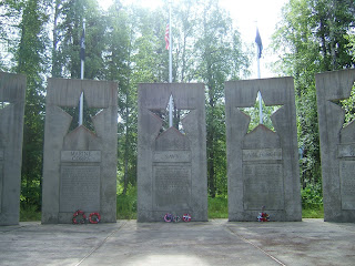
We drove back and continued into the town of Soldotna. World War II veterans were among the very first homesteaders here. The area opened for homesteading in 1947 and veterans were granted a 90-day preference over non-veterans in choosing and filing for land. Getting to the area was difficult; some flew or took a barge to Kenai, then walked the 11 miles to Soldotna. Others took a train to Moose Pass and sloshed 70 miles through mud. In 1949, Soldotna obtained its first post office and the town was settled.

Soldotna is a pretty busy place, full of stores, outfitters, and tour offices. However, the Visitor Center is “Where its at”. The Kenai River is one of Alaska’s great treasures and runs right through town and past the center. The watershed covers 2200 square miles. They’ve built a 250 ft Classic Fish walk. The iron walk can be accessed by a set of stairs. Because the river does not have a gentle sloping bank the walk meanders along the shoreline to protect the vegetation. There are steps that go right down into the water where you can wade and benches where you can sit and watch the swift river and wildlife. There were a few people fishing today even though the weather is so miserable.

We decided not to fish today but the access is really good. Back at camp a caravan of 45 motor homes had arrived. They are the same ones that were in the campground in Fairbanks with us. We made pork tenderloin, potato and corn on the cob for dinner. We spent the evening trying to decide which tour we want to take while we’re here. We found one that would have us fishing with the bears. We need to learn more about it, but it looks great.

It was still a good day.

Saturday, June 26, 2010

Where The River Ends...


Cloudy but the rain has stopped. When the clouds lift hopefully we’ll be able to see the mountains across the inlet. Heading south down the Sterling Highway we stopped at Chief Kick Ass Cookhouse and had a great breakfast. Chief cooked for us and we spent some time talking with him. Chief looks like the local Bear!

Back on the road we passed the Russian River again. The river is even more crowded. We are driving along the rim of the Kenai Peninsular. The Lower Kenai’s ecosystem is entwined with the ocean. The highway passes through the Kenai National Wildlife Refuge over spruce forested hills and then descends into a low marshy wetland. The landscape here is constantly changing. The refuge covers almost two million acres of the central Kenai Peninsula. Much of the refuge, 1.35 million acres, is designated wilderness, but there re many areas easily accessible for camping, hiking, and wildlife viewing. It’s hard to visualize two million acres of wilderness!

We ambled into Sterling, which is a true Alaska homestead-style community with a rural flavor. In 1954 a post office was established and the name Sterling was formalized. Sterling is a popular recreation area with a peaceful canoe trail system, a multitude of fishing opportunities where the Kenai and Moose Rivers intersect, and great small local shops.

A short distance up the highway we were in Soldotna and turned onto the Kenai Spur Highway. Soldotna is a busy hub of the Kenai with lots of shops. We followed the Spur Highway 11 miles to Kenai and arrived at Beluga Point RV Park. It took just about an hour to get to Kenai. We wanted a site on the bluff. The owner said if we took an inside site tonight then we could move to a bluff site tomorrow. The park overlooks Cook Inlet with spectacular views. We’re told this is a great place to view Beluga Whales. The whales are white and they come in on the tide to feed. We hope we’ll see some while we’re here.

After setting up we walked along the beach to the mouth of the Kenai River. This is where the river meets the sea as it enters the Cook Inlet. The beach runs along the base of the bluff. It has beautiful soft sand and lots of shells. We found sand dollars as we walked along. The beach has one of the fastest tides in the world. The water is pretty grayish because its low tide.

After our beach walk we hopped in the jeep and did errands, stopped at Pizza Hut and then headed off to the Peninsula Oilers baseball game against the Mat-su Miners. The Oilers are one of 6 teams that make up the Alaska Baseball League. This is an elite group of college players mostly from the lower 48. In their 35 year history many of the players have gone on to the major leagues and have won Cy Young Awards and played in the World Series. The league is strictly paid for by volunteer donations. We found seats right behind home plate. Next to us was a local man who was involved with the team. We learned the land was leased to the team by the city. Volunteers cleared the forested site, and built a beautiful ball field. The folks here are really proud of what they built. Tonight was “free” admission. We had a great time, became instant locals and got back to camp about 10pm.

The sun is still out! Sunset is 11:45pm tonight and sunrise is a little after 4am…it never really gets dark. Its nice being back by the water again.

Photos: Beluga Beach and Mount Redoubt Volcano, Sunset from the bluff, Sunset across the inlet at 11:45pm, Alaska summer darkness at midnight.

Friday, June 25, 2010

Finding Cooper Lake


Cloudy, cold, and showery. We are staying at camp to get some things done and enjoy where we are. To be truthful we don’t usually spend much time in camp. I spent most of the day updating the log because I got too far behind. In order to do this blog. I keep a handwritten daily log so I have notes I can use. We got the routings ready for tomorrow and Ken did some maintenance stuff.

About 3:30 we walked around the campground and along the boardwalk that runs beside Quartz Creek. We followed the camp road to another trail which led out to Kenai Lake. The lake has gorgeous turquoise water which is hard to describe. It looks like a large pool of emeralds. We walked along the beach, and then went back to camp. If the wind ever goes down we would take the kayaks out.

Hopping into the jeep we drove up the Sterling Highway and over the Kenai Bridge to Snug Harbor Road. We're on another excursion and who knows what we'll find today. We mailed some post cards and continued on until the road turned to gravel (of course). We wound our way on this narrow road along the shoreline of Kenai Lake for about 8 miles watching for wildlife. We slowed as a porcupine waddled across the road in front of us. The road started a gradual climb and we found ourselves in a mountain valley filled with ponds, ferns, and spruce trees. We passed a ¼ mile trail for Rainbow Lake and reached the Russian Lakes area. This is a 23 mile trail popular with hikers and mountain bikers. Further up the road we passed through a cut in a rock wall covered with ferns and vines.

Shortly the road ended at a gate and a dirt road led off to the left to Cooper Lake. It was fantastic. There were beautiful views of the snow capped Kenai Mountains across the water. As we pulled up to the lake 2 guys were getting ready to leave. They hadn’t had much luck. We pulled in and parked in a cove, had a snack, and then we fished for a while. The lake is stocked with Rainbow Trout but none for us today.

On the way back we stopped at Gwins Lodge for a bite. This is supposedly a landmark. We had “World Famous Salmon Chowder” eh, miserable quiche, and two beers for $52...rip-off.

Back at camp we just relaxed.

It was a good day.

Photos: Kenai River view from campground, Rainbow lake, Cooper Lake Cut (2), Cooper Lake (2)

Thursday, June 24, 2010

Exploring Skilak Lake


Another sunny day and we eventually headed out to take a scenic drive on the Skilak Lake Loop Rd. Driving south on the Sterling Highway through Cooper Landing there are dozens of cabins, restaurants, and guides/outfitters. We stopped at the Kenai Wildlife refuge Visitor Center and got some of our wildlife questions answered and picked up a book of fishing regulations. Then we were off ….

We turned left onto the gravel road to the Skilak Lake. Hopefully we’ll be able to fish if we can find a place that’s comfortable and open. This is a large habitat for brown bear (grizzly) so we are being very careful. First stop was Jims Landing day use area on the Kenai River, but the parking lot was completely full. We walked along the river fence but there wasn’t much activity so we headed out again. The color of the river is brilliant turquoise and its phenomenal. Hidden Lake was further down the road and after navigating the gravel washboards we stopped at an overlook. Every new spot is more pristine and amazing than the last.

Skilak Lake is very large and has several campgrounds which we checked out. After a while we laughed about turning a 19 mile drive into an all day adventure - we’re good at that. Still not finding a place to fish - eh - very frustrating. We moved on to the upper part of Skilak which is beautiful. The temperature had gotten warmer now and Ohmer Lake was our next stop. We meandered along the beach, and watched some boats. Maybe we’ll put ours in tomorrow depending on the weather. It’s been pretty windy. Now we wish we had gotten kayaks instead of the pontoon boat…. We’d be in the water by now. As we continued on Ken said “look”… a bear crossed the road about 200 yards ahead. He was a good size one. The last turnoff was Botteninthnin Lake and we parked in hopes of seeing some loons or grebes. None there so we had a snack and started back.

We stopped again at the Russian River and watched for a while. We tried to set up a guided fishing trip using our Alaska Saver Coupon for a local outfitter. They told us they were only doing full day trips for $650 (for 2) - no thanks. They said we could do a “walk in trip” on the river at 2:30am for just a little less…sounded shifty so we decided to wait.

Hopefully tomorrow will be nicer. We had sausage & peppers for dinner. It clouded up this evening and its cool and windy. Ken saw a moose walk through the camp across from us. There’s also a little black bear that has been terrorizing the bear box at 4am with no luck. The tenters down the way heard him. I don’t think I’d be tenting up here!

It was a good day.

Photos: Kenai River, Skilak Lake Road, Skilak Lake Overview, Botteninthnin Lake

Wednesday, June 23, 2010

Bearfootin'.....


Once we reached the Kenai Peninsular it was time to go “Bearfooting”! “Bearfooting is a verb meaning ‘having a good time on the road’. It’s also a state of mind - when your travel becomes more important than your destination. We find ourselves waking up in the morning and we have no idea what day of the week it is. What’s more we don’t care!

We had a sunny start as we decided what to do today. Lewis came by to get some of our Salmon so he could marinate it for dinner. Dale told us where we could see real combat fishing on the Russian River.

Leaving the camp we turned right up Quartz Creek Rd which breaks into a Y we went left first and followed a single track road thru the woods. It didn’t seem to go any where so back to the Y and went right. After a few miles the road ended at a deserted part of Kenai Lake. It was awesome. The lake is a glacial turquoise green and surrounded by mountains. The shoreline runs right along the shoreline of the campground. We spent some time on the rock beach.

We then headed back down the road to Sterling Highway. On our left was a little place called the Kingfisher Roadhouse. It overlooked the spectacular Kenai Lake so we stopped for lunch. Inside the roadhouse had burl wood post tables and the tops were thick slabs of polished wood in various shapes. Benches covered with tapestry cushions made it very comfy. We sat out on a screen porch overlooking the water and had a great lunch.

Leaving the roadhouse we found the Russian River and pulled into the parking lot. In the parking lot you can see most anything, old campers, cars,’sacked out’ fishermen. They arrive early in the mornings and some live in the parking lot for a week during the run. This is the hotspot and the Red Salmon are running…slowly! People are shoulder to shoulder along the banks casting for the prize. Its very crowded. We walked down to a spot in the river where we could watch. Along the fence there were signs “Fish Hook Removal call Dr. …”. Gives you an idea how crazy this type of fishing is! We didn’t have the right kind of rods to fish with so we sat on some steps at the edge of the water and watched for a couple hours. It seemed like the opposite bank was getting all the action. To get across the river you take a little rope ferry across the current. It was fun to watch.

Leaving the river we went back to camp and got ready for dinner. Snacks at 7pm and yummy dinner - pork chops cooked in cast iron on the campfire and salmon. Today was Dale’s birthday so we all celebrated - again…
Now we have more new friends and we will definitely connect with Dale and Judy when we go to Albuquerque. We got home about 11:30.

It was a great day.

Photos: Kenai Lake Beach, Russian River Combat Fishing, Sleeping Fishermen, Russian River Ferry, Dale's Birthday

Tuesday, June 22, 2010

Turnagain Arm


Leaving the town of Willow and the Denali area of the Mat-Su-Valley we move into the Lake Country region of Alaska. Rolling along the Parks Highway we passed the turn off for Nancy Lake State Recreation Area and soon crossed into the roadside community of Houston, Alaska. To our left on a hill was the Gold Miners Lodge and this was our breakfast stop. Just a small wooden building we walked into a large room with a wall divider. To our right was the bar and pool tables and to our left was the dining area. We picked a table and was told we could have eggs any way with bacon or sausage - that was the menu. While we waited we looked at the old local mining photos from the early 1900’s that covered the walls.

Happy and full we were on our way again. We crossed the Little Susitna River. Known for having one of the largest Silver Salmon runs in south central Alaska. A sign caught our eye as I read the “caution Moose Danger Zone next 12.7 miles!” We didn’t see any this morning, but the area is low marsh on both sides of the road and perfect habitat.

Soon we rolled into Wasilla Alaska! Thirty years ago Wasilla was just a “blinking yellow light” on the Parks Highway. It had a country store and a gas station. Once the Trans-Alaska Pipeline began construction new wealth entered the area. The only inkling that Wasilla was going to change was a small cabin by the side of the road with a very large banner offering “Land”. Wasilla was on its way! Sarah was away so we couldn’t “do lunch”. We made a stop at Wal Mart and stocked up on groceries.

Coming out of Wasilla there is a huge interchange where the Parks Highway (Rte 3) and the Glenn Highway (Rte 1) meet. We followed the signs to Anchorage and made it through the city without any problem. We ambled through suburbs like Peters Creek and Eagle River. We passed Fort Richardson, home of “America’s Arctic Warriors”. They are a military command of the U.S. Army located in Alaska. Carefully winding our way through the city of Anchorage we closely followed the signs for our connection to the Seward Highway. The routing wasn’t as bad as we expected. We’ll follow the spectacular Seward Highway 127 miles along the north shore of Turnagain Arm through the Chugach State Park and National Forest.

Turnagain Arm connects the Kenai Peninsula to Anchorage. Captain Cook got lost here and had to turn his ship around - again…. The “arm” is an easterly extension of Cook Inlet. Its known for having one of the world’s remarkably high tides. A bore tide is an abrupt rise of tidal water just after low tide, moving rapidly landward, formed by a flood tide surging into a constricted inlet such as Turnagain. Foaming walls of water may reach a height of 6 feet and is very dangerous. The highway hugs the shore along the “arm” which is all mud flats until the tide arrives.

The panoramic view of the Kenai Mountains on the south shore is fantastic. The rocky peaks rise sharply from the shoreline to heights of about 4,000 ft. Next the Beluga Point pull out provides a commanding view of Turnagain Arm and a photo stop. We stopped hoping to see Beluga Whales. Our timing wasn’t very good as it’s low tide and they come in with the tide feeding on Hooligan (fish) and Salmon. Belugas are easy to spot because they’re all white. We did see some Dall Sheep on the mountain side across the road. While in the pull off we met up with a couple from Nova Scotia we first met in Denali. We talked for a while and then continued on.

Further on we stopped at another pull off to take a picture. We talked with a local woman who told us the Tidal Bore was due to come through in the next 20 minutes. The tide was already late per the tide schedule. We waited, saw Bald Eagles, but no tide so after half an hour we continued on. In 1964 the Good Friday Earthquake affected Turnagain Arm causing the land to sink. As a result the tree root systems were saturated with salt water and today there are stands of dead trees everywhere.

The highway along Turnigain Arm area is gorgeous. Coming over a rise we entered the Chugach National Forest and rounding a curve we both exclaimed, “WOW!”. The view in front of us was incredible. The Spencer Glacier was directly in front of us surrounded by mountains. As we drive along there are waterfalls cascading down through the rocks and we can hear their thunder long before seeing them.

The Welcome to the Kenai Peninsula sign appeared on our right letting us know we just crossed the isthmus that separates the peninsula from the rest of south central Alaska. We turned south onto the Sterling Highway. The highway follows the Kenai River all the way south to Homer. A few miles later we turned onto Quartz Creek Rd and followed it to the USFS Quartz Creek Campground in Cooper Landing. We pulled in and they had one space for 2 nights - we wanted to stay longer so we are hoping another site opens up tomorrow.

We had dinner and Ken went to pay for the site. As I did dishes there’s a knock on our door. “Hi”, says the man from next door, “could you take a picture for us?” They were having a birthday party. His name was Dale, and Lewis was having the birthday. Sure enough I took the picture and we were invited over for the evening. We met Dale’s wife Judy, and Janice, and Joel who belonged to Lewis. Really nice folks. We spent a great evening around the campfire getting to know each other. Dale & Judy are from Albuquerque. Dale invited us to join them for his birthday party the next night. Yes, these are real birthdays….

About 10pm we walked back to camp and called it a day.

Today was great.

Pictures: Along Seward Highway, Turnagain Arm, Beluga Point, Spencer Glacier

Monday, June 21, 2010

Talkeetna - Colorful Characters


Had breakfast and hung out at camp. We decided to take the 14 mile spur road off the Parks Highway to a little community where the road dead ends. This is a unique mix of old-time, small town Alaska and a favorite tourist stop.

Talkeetna has a lot of colorful history. When Mary Carey arrived in Alaska in 1962 she found work as a schoolteacher. Here she met the famous bush pilot Don Shelton who was famous for flying climbers onto Mt. McKinley. While in Talkeetna Mary continued her photojournalist role for Fairbanks and Anchorage newspapers. She was the first woman to fly onto Mt. McKinley with Sheldon to take photos of climbers trying to scale the mountain. Later she built her own cabin with a view of Mt McKinley and ran the Fiddlehead Fern Farm, one of the few places like it in the United States. Here she wrote several books. Today Talkeetna is a key jumping off point for climbers who are making the trek up Mt. McKinley and is still full of colorful characters.

There is one main street and it has an eclectic mix of gift shops, outfitters housed in log cabins and wooden decks inviting you into cafes like the Wildflower. We parked and walked down Main St. past the micro brewery tasting sign and noticed many of the places had folk and jazz music in the evenings. Just about at the end of the street was a little wooden building with an outdoor patio, somehow it felt perfect so we entered the Mountain High Pizza Pie for lunch. Picking a table outside we could watch the street. The tables were round metal garden style and were painted bright colors. The metal chairs were mixed with blue, pink, yellow and green. We ordered pizza and had a blast people watching. We saw grandparents with grandkids, families on bicycles with babies in pull wagons, flower people from the 60’s, a great mix of tourists from all over the world, locals who looked like miners, and backpackers of all shapes and models!

Our waitress told us to follow the path at the end of the road to the Talkeetna River. It was a really nice day and the air was filled with floating white fuzz from the Willow trees. It really looked like it was snowing at times. We passed the Chocolate store which had a sign out front, “Please leave your guns, food, drink and strollers outside!” Yes many folks here carry good size weapons - this is bear country….

We caught a small peak at Denali across the river and then walked back down Main St. Nagley’s General Store has been in business since 1921 and it hasn’t changed much. It’s the key place for general merchandise for the locals and tourists. We parked ourselves on a wooden bench in front of the store, got an ice cream, and watched the other end of the street. We noticed an old - well used - Blue Bird bus across the street. We had seen this same bus parked in downtown Denali. It looked like it had a ton of miles on it and there were definitely people living in it. As we watched three young men proceeded to fill the bus with water from the old Fairview Inn. They were interesting and looked like they had been on the road a long time. One of the men walked by us and Ken asked how long they’d been out. Two months he responded. They were a band from New Orleans traveling the country. Later we saw a man on a four wheeler with his dog in a basket decked out in sun glasses and baseball cap -

Eventually we walked back to the Mountain High Pizza to quench our thirst. Watching people is tough work! We listened to a woman playing folk music and she did a nice job on Janis Joplin numbers.

Soon it was time to wander back to the car and head out of town. We stopped at a scenic overlook, and just as we started to leave a young moose walked down the sidewalk right past us. It was really cute with it’s really long legs.

Back at camp we went down to the water and watched the combat fishing. It’s about 10pm and the sun is still out. This is Summer Solstice and the sun won’t go down til midnight. The light gets dusky but there really isn’t a sunset like we know it. There is some pink in the sky then it proceeds to get brighter. I stayed up until midnight and watched the sky against the silhouetted trees. The light was like a cloudy day - it was really neat!

We had a great day today.

Pictures: Talkeetna Main St, Mountain High Pizza Pie, Chocolate Store, Talkeetna River and Denali, Nagley Store (look for Ken), Young Moose, Susitna Landing Fishing at 10pm


Sunday, June 20, 2010

Remembrance and History


Clouds and sun mixed as we headed south down the Parks Highway. We passed Summit Lake and climbed through Broad Pass. The mountain pass is one of the lowest summits in the North American mountain system. The mountain valley, bare in spots, and dotted with scrub spruce in others is surrounded by spectacular snow capped peaks. Fortunately there is very little wind as we cross the 550 ft deck of the Hurricane Gulch bridge looking down 260 ft below to Hurricane Creek! The highway winds through Denali State Park and past several trailheads and pull offs with views of Mt McKinley, except today it’s sleeping in a blanket of clouds.

Our first stop is the Medal of Honor Loop which leads to the Alaska Veterans Memorial. A gravel path leads to an alcove in the woods and a semi circle of 20 ft tall concrete panels. The panels represent each branch of service with inscriptions at the bottom and a large star at the top. Plaques also pay respect to the National Guard and Merchant Marines. The memorial reads: " We dedicate this quiet place to the remembrance of the veterans of Alaska who have served their country at home and through out the world. We honor their herioism and dedication". We spent about ½ an hour in this beautiful and peaceful spot. It’s a very moving memorial.

Back on the road we stopped at Mary’s McKinley View Lodge. This is the historic homestead of Mary Carey. Mary, recently widowed, moved to Alaska from Texas and homesteaded before the state park was created. She fought for highway completion to shre her magnificent view with travelers. We had a great lunch - grilled roast beef sandwich - and met Mary Carey’s daughter Jean Richardson. Jean signed the book she wrote about her mothers life in Alaska “Alaska, Not For A Woman” . I can’t wait to read it.

The landscape has changed again and is more like New Hampshire with rolling hills and lots of deciduous trees. Wildflowers in purple and hot pink dot the sides of the road. We passed towns like Trappers Creek, Talkeetna, and soon arrived in Willow.

We found the RV park at Susitna Landing which had changed hands and was state owned now - no showers or wifi - hmm - we had to go to Caswells store for showers! We found our site in the wooded area. Most everyone was gone and we had a beautiful site.

The hard core fishing folks were in the “rough it” section down near the Susitna River. The river is a very popular King Salmon fishery and we walked over to watch the “Combat Fishing”. This type of fishing is where they stand almost shoulder to shoulder and cast so the line floats toward the next person. Then they reel it in and recast. - No Thanks too close for me -

We went to Caswells for our $5 showers which were great and then back to camp. We had dinner and wandered back down to the river. We saw one person catch a fish, but there wasn't much action. The people fishing had all been there for hours. Later we sat outside for a while and then went to bed.

It was good day.

Pictures: Alaska Veterans Memorial (3), Susitna Landing Campsite