Monday, February 22, 2010

Pheasant Run

This morning is cloudy, windy, and cool. We have an 11:30am tee time at Pheasant Run Golf Course. We suited up with rain jackets, fleece, and warm shirts and off we went. We got to the course early and there was no one on the course so we hit the links! It was nice we got to play by ourselves today. The weather cooperated again and the sun came out and it got warm.

There is a water way that runs down the side of one of the fairways. Of course I hit my ball near the water and as I got out of the cart to hit my ball about 6 ducks and geese charged across the rough to say hello. We had to chase them away. Maybe this should be called 'Goose Run'.
The day was fun. This was a really nice park and we liked the ability to play golf.

Back at camp we got things together for our trip home tomorrow. We watched TV and then went to bed.

Note: We will head home tomorrow from Sacramento. While we're home I'll be working on the Blog from our last trip. Catch up with us again starting March 11 as we head for Alaska!


Sunday, February 21, 2010

Madera Wine Trail


Cloudy and showers today so this is the perfect day to do the Madera Wine Trail! Down Rte 99 S. I haven’t talked much about this route but in it’s heyday Rte 99 was known as ‘California’s Main Street’. It provides all the pleasures of a back road. Clustered alongside 99 like cherries on a tree are dozens of cities and towns. This offers hundreds of spots to pull off and enjoy the special experience of discovering a new place.

Turning onto Rte 145 wee drove through blooming almond orchards and then onto Rte 41 N which is a main route to Yosemite National Park. Madera County is one of the oldest wine growing regions in California. In the mid 1800’s settlers from Italy, Armenia, Spain, France and many other countries settled here. They planted grapes on their family farms traditional to their homelands. Before the turn of the century “Madera” labeled wines were being shipped worldwide. The county has been known for producing internationally acclaimed dessert wines for a long time.

We checked out the wine trail map before heading out to identify the route we wanted to take. (Note - several wineries only offer tastings by appointment.) Our 1st stop was Vineyard 208. The vineyard sits at the doorstop of the Sierra Foothills. They offer fine Italian wines. Unfortunately they were closed today…. Oh well next!

Back down Rte 41 S to Road 36 (all the road names are numbers here…) the next stop was Birdstone Winery. Birdstone had a really pretty patio and garden set up with a tasting bar outside, but it was raining so we went into the cask tasting room. Kimberly greeted us and explained about the wines they were offering. We tasted several, but were more interested in the Port. Their Tinta Port was clear and tawny colored and perfect. Ken’s eyes lit up just at the aroma! As we were tasting another group of folks joined us. They had been to Alaska and they told us about several places we should visit. This is how we learn about all the places that are ‘off the beaten track’. The owner of the winery joined us and explained about the history of the winery and local crops. He was the one that told us the pink and white blooming trees were almonds and not cherries. He brought out an Orange Muscat wine they are working on so we could give him some feedback. We had never had a Muscat before and it was really good very smooth. We took a business card so we could order some later. Naturally we purchased a bottle of Port.

Sitting unobtrusively on a back road is the home of Ficklin Tinta Port. Rolling up the vineyard road the vines looked really narly and interesting as they stretched for miles. We learned here that the wine cannot be called a Port unless it is created in the Portuguese tradition. The family has raised grapes since 1918. First growing fruit and raisin grapes they decided to grow wine grapes in the 1940's. They continued to add acreage and test and grow fine Portuguese Grape varieties. In the early 50's they marketed their first few hundred cases. Today they have 35 acres planted and the winery is still run by family members. We tasted two ports and they were very good. However, the lady giving the tasting introduced something new and the best part was yet to come. They also make a desert wine called a Passport. They can't call these ports as they are not made in the Portuguese tradition. First we tasted Rasberry, Black Rasberry, Hazelnut, and Chocolate Passports. They are smooth and just sweet enough. Now she mixed the Rasberry with the Chocolate and the Hazelnut with the Chocolate.....oohh... they were fantastic. We bought a bottle of each! This was fun and we learned a lot.

Next the nationally acclaimed Quady Winery. they specialize in dessert and aperitif wines. David was our host and he was very excited we were from the East as he grew up in Portland, Maine. He explained about their wines and suggested recipies and explained how these wines would complement them. We learned he was a chef. We tasted several wines and the new wine here was the Vya Aperitif Vermouth. We never expected to drink Vermouth, but this is a fortified wine made with botanicals. It is made with a blend of the Colombard and Orange Muscat grapes with a selection of whole dried herbs from above ground plants. Lavender, rose petals, citrus are a few of the herbs infused into Vya. There is both a dry and sweet Vya and when combined in a cocktail it's wonderful. It was close to closing time and we were the only ones in the tasting room so after the tasting he gave us a tour of the winery. It was very interesting.

Back on the road we decided we were hungry. Finding ourselves at the crossroads of Rte 145 and Rte 41 we were 10 minutes from the Table Mountain Casino. We turned right onto Rte 41 and headed to the casino for dinner. Naturally we visited more than the dinner table. Later we headed home.

It was a really sweet day and now we have to figure out where to store all these bottles!


Saturday, February 20, 2010

The Links


Slept late this morning and then went to breakfast at "Putters" (golf course restaurant) before getting ready to play golf. We are staying at The Links RV Park. A round of golf every day is included in the fee for our camp site. Pheasant Run Golf Course is right next to the RV park. The entrance is lined with Almond Trees and has a rock waterfall in front.

Arriving for our tee time we were paired with another couple from British Columbia. Mike and Darlene were really nice folks. Ken played well and I had ...a day...but it's the first time I have been out this year. The course was really pretty and the sun came out so we had a great day. The course is very long and has a lot of water so it was definitely challenging. After playing we sat on the patio, had a glass of wine and just enjoyed the view.

It was a good day. We may go to the driving range tomorrow before playing again on Monday... practice practice practice... eh...

Thursday, February 18, 2010

Tiger By The Tail

No plans for today and we decided just to hang out. Bakersfield has a great history of music from defining country music to hard hitting rock. This is home to the "Bakersfield Sound" started by hometown legends Buck Owens and Merle Haggard. Buck Owens was much more than just a "Hee-Haw" star. The life of this music legend is celebrated at The Crystal Palace. This award winning restaurant, museum, and theatre is a lasting monument to his success. The palace regularly hosts today's popular country stars. The rock comes from a group called Korn, who began as a local metal based band called LAPD. Bakersfield continues to promote it's local talent on stages and clubs.

Even though we like country and honky tonk we decided to leave the music venues for the next time we come to town.

The weather has been great and we took a walk around the park tonight after dinner. The temperatures tonight are in the 50's and we hope the weather continues.

Wednesday, February 17, 2010

Wild and Scenic


We wanted to get out of the city today and explore the southern tip of the Sequoia National Forest. Riding along Rte 178 W we had no idea what was waiting for us. Once out of town we are in the Central Valley and it's really green with a heavy haze. All the flowering shrubs and trees are starting to bloom with blue and pink & white flowers. Gorgeous lush rolling hills of green against a backdrop of the huge granite Tahachapi Mountains. The mountains are rugged with rocky ledges winding through the Kern River Canyon. When you look up you can't see the top of the mountains.

The road follows the wild and scenic Kern River. Rushing water crashes over boulders in mini waterfalls as it rumbles over it's rocky path. Climbing out of the canyon and around narrow blind curves we came into the town of Lake Isabelle. The town is small with many whitewater tour companies. This is a big raft launching point during the summer. We followed the narrow Sierra Way, which is closed in winter, through the small historic gold mining town of Kernville. The road is lined with Pinyon Pine and the peaks rising above us are dusted with snow. We continued up the windy road looking for the Trail of 100 Giants, the southernmost grove of mighty Giant Sequoias which was suppose to be 13 miles up the road. (Never found it...) The beauty gets better with every turn. We found the Hospital Flat Campground, which was closed, but we decided to stop and have a picnic lunch anyway. Parking across the street we found a table in the trees next to a little stone wall and had lunch. It was amazing having this incredible place to ourselves.

After lunch we continued on. There were warning signs that the road was closed about 21 miles further on. Continuing the road is getting narrower and the tight S turns are becoming more frequent. Climbing we passed the turn off to the Sherman Pass (9200 feet). We didn't take the pass road, but did continue climbing until we started to see snow on the side of the road. Now we are up over 8000 feet with tight curves, drop offs, and deeper snow so we decided to turn around in the next turn out. Carefully we wound our way back down, now on the outside, to Kernville. On the way we pulled into a river access parking area to look down from a bridge into the river. Suddenly a fighter jet came soaring up and over the crest of a mountain just over our heads. We couldn't hear him until he went past and then the roar over took us. In this quiet setting it was awesome.

Back in Kernville we decided to take Rte 155 W back to Bakersfield. The route took us over the Greenhorn Summit (6,102 ft) and through plenty of snow. Cedar trees lined the road and in the damp the smell was really strong and fresh. We chose the shorter way home which leads south through Linns Valley and the former Butterfield Stagecoach stop of Granite Station. The Butterfield Overland Mail Company stagecoach service was commissioned by the US Postal Service. It connected St. Louis, Missouri, and Memphis, Tennessee, with San Francisco, California to improve communications between the East and West. The finely crafted Concord coach carried six passengers, plus the conductor and driver through the Southwestern desert. Passengers rode three abreast in the coach, on facing padded leather seats. There was ample room for their legs and a boot in the back for their baggage and the mail. The coach stopped for unhurried meals and rest at various way stations. The passengers suffered only briefly from dust and snow storms, but worried about Geronimo’s marauding Apaches. The stage from San Francisco was scheduled to take 25 days to arrive in St Louis. Granite Station was built in 1873 by John Elden, the monument marks a stand of buildings which served as store, restaurant, and lodging places on the stage route from Bakersfield to Glennville. In later years it became a stopping place for freighters and sheepmen who were on their trek to the Mojave Desert.

It's now 4:30pm and the fog is starting to float over the valley and gives it a haunting feeling. On the way back we stopped at a place called Rosa's for Italian food. This was recommended to us by one of the folks at camp so we found our way there. It was pretty good.

It was a beautiful day. The roads were scary and spectacularly gorgeous.

Picture note: Kern River Canyon Rte 178, Kern River, Hospital Flat lunch, Hospital Flat Campground, Narrow Sierra Way, Mountain Jet came over, Over Greenhorn Mtn.

Tuesday, February 16, 2010

The Grapevine

Sunny and warm as we travel to Bakersfield. I learned to unhook the coach connections this morning. I need to be sure I can do the outside stuff as well as the inside.

We stopped for gas this morning as we left California City. Ken was talking to this guy at the pumps who was really interested in the coach. Sure enough we ended up giving our first gas station Coach House tour! We never know when or where these tours will happen.

Riding down Rte 14S we can hardly see the mountains with the haze. There were heavy fog warnings this morning so we left camp a little later than usual. We turned onto Rte 138 W which will take us to I5 N where we will drive the "Grapevine" pass today. Beautiful rolling hills look like green velvet and we can see grass! The buds are starting to show on the trees and the Cottonwood Trees are leafing. The hills are dotted with trees, not just pines, and as we came over a hill there was a sky blue reservoir sparkling in front of us. We have definitely left the desert!

The Los Padres National Forest on our left and the Tehachapi Mountains on the right we turn onto I5 N. We climb up to the summit of Tejon Pass (4144') and pass trucks full of lemons. The interstate is in awful shape! Once we get to the summit we start down the precipitous descent toward what is known as the Central Valley on the north. The descent ends in the small community of Grapevine at 1,499 feet. The pass is subject to sever weather and is often closed in the winter as road crews cannot keep up with the snowfall. We were lucky today. The fog is just hanging in the air but fortunately not on the road and the visibility is good. Coming down we see farms and cattle on the side of the mountains. The landscape has really changed. Orchards full of pink flowering trees and vinyards as far as the eye can see on our left. It is beautiful.

We turned onto Rte 99 N and enjoyed the green countryside. Our home for the next three nights is Southland RV park. We are just south of Bakersfield. We got settled in and did some errands. We had dinner at a little local place called Mary J's. Was pretty good and the menu was basic home cooking.

Back to camp we took a walk around the park and enjoyed the warm night air.

Monday, February 15, 2010

Just A Day

We decided this morning it was cleaning day. The coach really needed it, so after breakfast we vacuumed, cleaned, dusted, etc. - not real exciting...

Later we went into California City to the Green Tea Restaurant for dinner. We talked with the lady who owned the place. When she came to our table she asked "are you new in town or just passing through". We were surprised, but she explained the town is so small they know just about everyone and we were fresh faces. We told her about our trip and we talked for a while.

Back at camp we watched the Olympics and called it a day. California City is a nice small town and very friendly.

Sunday, February 14, 2010

Desert Trails

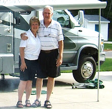
Happy Valentines Day everyone! We celebrated with coffee at our site and I made Ken a valentine from note paper... cute huh....

Down the road towards Twenty-Nine Palms our first stop will be breakfast (and not at the Saloon..). Our route will take us further into the Mojave Desert today. We travelled through the Morongo Valley and over part of the Little San Bernadino mountains through rolling hills on Rte 247 N. The Bullion Mountain Range on our left provides beautiful views while the USMC Training Center is located in the valley below. There are lots of desert buggys going by on trailers covered from top to bottom with mud and dirt. Off Road Vehicle Recreation is very big out here. We are seeing alot of motorhomes with OHV's pulled behind them. They camp in the desert for the weekend and ride. Looks like the more dirt the better!

Driving across the Mojave you can't get over how immense it is. Looking to our right the desert spreads as far as the eye can see. The road winds along the base of the Little San Bernadinos and the desert floor is covered with Creosote Bush and Mesquite. The Creosote give the floor a dark olive/brown color.

Further on the landscape changes and most plants disappear. We are driving across the bed of Lake Lucerne. Rte 247 goes right through the middle of the lake. It's a big mud hole in the middle of the desert! Ranches, ramshacle shacks, broken motor homes dot the landscape at the foot of the rugged brown mountains tinged with spring green as Rte 274 winds between. We've climbed to 3500 feet and as we look over the hill there is a beautiful valley spread before us. As we decend into the valley the Pisqah Crater and lava flow is on our right.Where the other mountains are light brown these are a charcoal color. The Pisgah Volcano is the youngest vent in the Lavic Lake volcanic field. Activity at this site may be as recent as 2,000 years ago, but experts think it more likely to have been 20,000 to 50,000 years.

Turning onto Interstate 15 S in Barstow and then onto Rte 58 the road begins as a freeway and then changes back and forth between 2 lanes and then 4 lanes. We pass Edwards Air Force Base and across Rogers Dry Lake. Further up the road we see pyramid shape mounds of dirt and rock in the middle of the plains. It looks like they were pushed up from underground.

Soon we rolled into the town of California City and the Sierra Trails Campground which will be our stop for the next 2 nights. Most of these parks have a lot of full time residents. We settled in and took a ride into town. California City is a small place with very hard working people. We stopped at the grocery to pick up a couple of things (like Hostess Cup Cakes for Ken) and then went back to camp.

Today we saw great scenery and just enjoyed the differences between home and the desert.


Saturday, February 13, 2010

Hidden Valley


I don't think we realized how big this park really was. We saw half of it yesterday and we will do the other half today. All of the campgrounds are full and there are people (day trippers) everywhere. First thing on the agenda was to check out Joshua Tree and get gas for the car and breakfast for us. Nothing like a little local color at the Joshua Tree Saloon to go with our eggs. We should know better by now!

Back into the park - eh a line at the entrance gate - we forgot it was a long holiday weekend so 20 minutes later we are on our way again. Hidden Valley was our first stop. A foot path lead us through what looked like a rock wall as we worked our way to the trail head. In the 1800's a rancher blasted his way through the rocks and found a lush valley. He grazed his cattle here, but eventually the water was gone and the valley turned to desert. A one-mile loop trail winds among massive boulders and jumbled rocks through what became a legendary cattle rustlers' hideout. The trail took us up rock steps and over boulders. We watched several groups of people climbing the shear rock walls. This is a real climbing hot spot for this area of California and they are streaming in here by the car loads. We really enjoyed the hike and varying views. Unfortunately we were reminded of how treacherous rock climbing can be. The police and ambulence were in the parking lot and there had been a climbing accident.

We left Hidden Valley for Barker Dam and our next trail. The dam was build in the 1900's to hold water for cattle and mining use. Today it forms a small rain-fed reservoir and provides water to the parks wildlife. As we scrambled over boulders and through little streams we saw birds everywhere. The park has many different ecosystems and this was very different from Hidden Valley. Here we found Pinyon Pine, and Pinyon Juniper that grow in the wetter areas with Mojave Yucca and Noline as well as several types of cactus in the dryer areas. The greens and desert browns were broken by the Red Top Buckwheat which is growing in clusters with tall red spikes on the desert floor. We noticed something move on a small branch of a bush just off the trail. It was a little Kangaroo Rat. He was munching on the wooden branch that didn't look big enough to hold him!

Our last stop was Keys View. Our overlook is perched on a crest of the Little San Bernadino Mountains at an elevation of 5,185 feet. The expanse of Coachella Valley, mountains, and desert is stunning. In front of us we can see the San Andreas Fault. We could see back to Palm Springs and the Salton Sea! The fault to the west is slipping East and if we returned several years from now we would be considerable farther east than we are today. It's a weird feeling to think we were watching the fault line and moving at the same time. The ranger told us this was the place to come for sunrises... but we usually miss these..

Back at camp we relaxed and watched all the people race around, then we went to Twenty-Nine Palms for pizza. When we got back it was dark and the stars were phenominal! There are no man made lights out here and boy is it dark!
Tomorrow we leave. We are starting to head towards Sacramento slowly. We enjoyed the park alot and we can see why it's so popular with the local folks.

Note: Picture top right is the San Andreas Fault line. You can see it at the base of the snowy mountains.

Friday, February 12, 2010

Cottonwood Spring Oasis


Off to explore Cottonwood Spring Oasis this morning. The oasis is at the south end of the park about 4000 feet lower than the campground. On the way we decided to check out some of the other campgrounds on our way. Belle Campground was really nice and had some sites we would have fit in. The sites were nestled in among the huge boulders and more private than where we are.

Traveling along the Pinto Basin Road there are exhibits telling about the plants, geology, animals and history. We turned into one exhibit which sat at the entrance of a dirt road! We had to go.... A couple miles in we came to a cul-de-sac in an area piled high with boulders. The map said this was Wilson Canyon and there was absolutely no one there! We walked through the canyon and found a hidden rock valley with jumbled boulders balancing precariously on top of one another. Ken said this was "Lone Ranger" country. History says rustlers and 'bad guys' used to hide out in these canyons - you'd never find them...

The desert floor is really changing. We are enjoying learning about all the different plants. The Joshua Tree is the namesake for the park. The tree got it's name from the Indians saying it looked like a spirit welcoming them with open arms. The settlers later named it after Joshua because they thought the tree looked like it was leading the way to their new homes. It isn't really a tree but a member of the Yucca family. It has waxy dagger-like leaves and can grow over 40 feet tall. Unfortunately we will miss the cream colored flowers that will be blooming in another week or so. The trees had long spike like buds on them but no flowers. The side of the road is covered with Brittle Brush with clusters of yellow daisy like flowers. In the crevasses the Barrel Cactuses are turning pinkish in the sunlight. We passed paths that led up into the foothills to the remains of the Silver Bell Mine where they mined for gold.

Going down in elevation the Joshua Trees start to disappear and there is more cactus, mesquite and creosote bushes. Creosote is known as desert Governors. They can secrete a chemical through their roots to keep other plants from growing next to them. Their roots can go down as far as 60 feet. We notice a lot more Cholla Cactus and pull into the Cholla Garden. The garden is located on the western rim of the Pinto Basin. The basin seldom gets more than a scant four inches of rain fall within a year's time. Down the self-guiding nature trail we went. There are several types of Cholla (Jumping Teddy Bear and Silver). The cactus is covered with soft, silvery bristles which account for the Teddy Bear name. These are nasty little plants and the spikes can be very painful if you get stuck with one. They are getting yellow buds on them. The ground and mountains are starting to take on a greenish tint in spots replacing the winter browns. It's fantastic to see the seasons change. In another few weeks this desert area will be a spring fantasy of blooms!

The Cottonwood Spring Oasis is one of the best kept secrets in the park. The spring is the result of earthquake activity and was used by the Cahuilla Indians who left bedrock mortars and clay pots in the area. Later the spring was an important water stop for propectors and miners traveling to the mines. We took the 1 mile walk through the Wash. The spring is an oasis and has a large stand of Fan Palms. When you're at one of the park's oasis you're on top of a crack in the Earth's crust. Man geological faults crisscross the park. When groundwater hits a fault, it comes up to the surface and sets conditions for an oasis. We sat on a rock and listened to the silence. It was a beautiful walk.

Heading back to camp we drove past Pinto Mountain and through Smoke Tree Wash. Yes thre are such things as Smoke Trees. They are small and have feaythery leaves. The color is a light taupe brown and green which does look like smoke and blends perfectly with the desert landscape. On the way back we stopped again in Wilson Canyon and had a picnic lunch, then climbed some rocks (not as easy as it looks!). We did feel like kids again.

Back at camp we relaxed for a while. After dinner we took the mile nature trail to Skull Rock. There is a huge rock that is worn by wind and rain and looks like a giant skull. It was a nice trail that led right out of the campground.

Today was good and we walked about 3.75 miles today through all kinds of terrain. We decided to stay another day so we can see the rest of the park. Now it's time to hit the hay.....

Thursday, February 11, 2010

Where Two Deserts Meet


It's crisp and clear as we head out of Desert Hot Springs on Dillon Rd to Indian Ave. Across the Coachella Valley we head for Joshua Tree National Park in Twenty-Nine Palms, California. It's sunny and warm with the snow capped Sand Bernadino Mountains on our left and rolling foothills which are starting to get a green tint with the brush turning from winter to spring. We turned onto State Highway 62 E driving through the Morongo Valley. Climbing through the foothills on this 2 lane road we wound our way through the pass and reached the summit of Onyx Mountain at 8443 feet. What goes up must come down and we decended steeply into the town of Yucca Valley. Soon we came to Joshua Tree and the park entrance. Checking in at the Ranger Station we found out that it was a long holiday weekend (oops we forget about these things now...). He suggested we stay at Jumbo Rocks Campground as it had larger spaces, so off we went.


This place is weird and fantastic at the same time. The campground is 23 miles into the park and the landscape changes from massive groups of boulders to flat plains like desert covered with Josua Trees. The sizes and formations of the boulders is unbelievable. The park is made up of two deserts, each with an ecosystem whos characteristics are determined mostly by elevation. Below 3000 feet the Colorado Desert takes up the eastern part of the park with natural gardens of ocotillo, cholla cactus, and creosote bush. The higher drier, and minimally cooler Mojave Desert is the special home of the Joshua Tree, from which the park takes it's name. Besides the Joshua Tree forests, the western section of the park has some of the most interesting displays of geology found in California's deserts. The strong geologic features here are hills of bare rock, most often broken up into loose boulders. The expanse of flatland between these hills is thinly forested with Joshua Trees. This combination makes this a very otherworldly place.


We pulled in and drove through what are really paths between the rock formations the size of 4-5 story buildings. We found site 43 and made it home for the next 3 days. We are back in the wild nestled in a corner with 2 perfect rock tables and no every day ammenties - we love it.


Later we drove the 9 miles to Twenty-Nine Palms to pick up a few supplies. We stopped at the visitor center and walked the nature trail at the Oasis of Mara. These trails are great as they identify the different plants, cactuses, and animals of the area. We saw lots of Desert Cottontails and a new bird - the Logerhead Shrike. American Indians were the initial people to live in the area of the Oasis. Later during the 1800's propectors and homesteaders followed. Back at camp we sat outside. We are enjoying having a picnic table again. It's cold here in the 30's so we decided not to have a fire outside tonight. They had snow here yesterday, but the sun is warm and in the 60's during the day. We played Scrabble and then went to bed.


Wednesday, February 10, 2010

Desert Wonders


Today we explore the Indian Canyons. In our research we found this was a 'must see' and they were right. We drove down Palm Canyon Drive again, but kept going through town. Soon we were passing amazing homes high on hilltops and Indian Canyons Golf Club - and then nothing but desert. We came to the entrance gate of a beautiful recreation oasis.

We are walking in the footsteps of the Aqua Caliente Cahuilla Indians who settled here centuries ago. There are 3 canyons here which are listed in the National Register of Historic Places. Our first stop was Andreas Canyon. Off on the scenic foot trail that lead us through the canyon, over boulders and through groves of statuesqe skirted palms. The path followed the Andreas Creek and we stopped to appreciate the unusual rock formations beside us and above us. Part way up the path we came to a spot and looked up to see camps way above us on the mountain tops.... how did they get up there? Lizards scurried across the path as we sat on a rock enjoying the contrasting greens of the fan palms and hundreds of different plants as we listened to the silence.

To contrast the Andreas Canyon we decided to see Palm Canyon next. We climbed up the winding road to the top of a hill looking out over the entire recreation oasis and Palm Springs valley. It was breathtaking. At the ranger station there were hummingbird feeders with about 8 hummingbirds fighting for positions. One of them was different and when I asked the Ranger what it was he said it was a Costa. He has a gorgeous purple head and when fending off other "hummers" his purple turns a floruesent violet. They were really fun to watch. Down a narrow foot path into the 15 mile long canyon. We find ourselves standing in a grove of Fan Palms that tower above us. The path leads along the Palm Canyon Creek and up into the hills. About a mile down the path crosses the creek. However, the water was high and we decided not to cross it so we turned back. There were several picnic areas along the way and we sat under a canopy of palms and enjoyed the cool air of this oasis in the desert. It's in the 70's now and we decided to head back to camp. While climbing back up the foot path we spotted a Desert Spiny Lizard sunning himself on a boulder. These lizards can be multi colored, but he was only showing his gold color today. We really enjoyed the hike and the magnificent wonders around us.

Tonight we met Glenn & Marcie for dinner. We went to the Fishermans Market in Palm Springs. It was good to see them again. The market sells fresh fish and is also a restaurant. It reminded us a lot of the Seafood Center we used to go to at home. We enjoyed exchanging stories about our RV escapades and then it was time to say good night.

It was a good day.


Tuesday, February 9, 2010

Fabulous Palm Springs Follies


Desert Pools is really growing on us. We have met some really nice folks. Clara and Morris are a really cute couple and they have invited us to visit them in the Albany area when we get back East. We just hung out this morning and did some housework.

Finally it's time to go to the Follies. The Plaza is what they call a 1930's Jewell Box Theatre. The outside hasn't changed much over the years. It just has more buildings around it now. There are no posts, 2 balconys, movie screen, stage, and comfy velvet seats that actually have lots of leg room. We arrived about 45 minutes early so we could catch the old black and white film clips of movies with Clark Gable, Hoppalong Cassidy, and Abbot & Costello who did - 'Who's On First'. Then it was time to 'Let The Good Times Roll' and that's exactly what they did. They sing, they dance, and their ancient - the youngest is 56 and the oldest working showgirl is 86 and fabulous! The showgirl costumes are right out of Zigfield Follies. The MC is quick witted and they had a really good ventrilloquist. I can't say enough about the show. The background of these performers is unbelieveable with 20 - 30 years on Broadway and Las Vegas in shows like Pal Joey, Mame, Lido in Paris. Several of them have danced with the likes of Gene Kelly, Mitzi Gaynor, Mickey Rooney and two were Radio City Rockettes. Four hours later we rode home singing and laughing - it was a great night. Oh we are on the Follies website. They took our picture in the audience dressed in our look alike rain jackets - guess the red stands out! I put the picture here so you wouldn't have to hunt through the other 240 people on their website. (LOL)

It was a great day. We have found some other things we want to do in the area so we have decided to stay another day.

Monday, February 8, 2010

Perfect Palm Springs


Sunny and in the 60's. We signed up at the Club House for the free dinner that comes with the resort promotion. I'm so excited - Chicken Fried Steak is on the menu - we've never had it so it will be a new adventure.

We called our friends Glenn & Marcie and began making plans to get together. Then we drove into Palm Springs. (Another Bucket List item gone!). This is a place I've always wanted to visit. Cruising down N. Palm Canyon Drive into town we passed the Coachella Valley Wind Farm. The farm is huge as it runs up and down the valley and along the mountain ridges. The joke here is these are what keeps Palm Springs so cool in the summer ...

Palm Springs is a slow paced little town and not what I expected at all. It's not filled with night clubs and loud music. It has a happy relaxed atmosphere. The streets are lined with palm trees, lots of gardens and flowering trees. The small shops offer everything from clothing to antiques (not the ones who live here).

If you're like me and love old movies and vaudeville this is your place. We strolled down Palm Canyon Drive along the Walk of Stars. The sidewalk has blocks with stars on them to honor those who worked in stage, film, radio, and the TV industry. The sidewalks stretch for miles and have hundreds of stars. We saw ones for Ruby Keeler, Howard Keel, Al Jolson, Marilyn Monroe, Lauren Bacall among others. We stopped to rest at the Aqua Caliente fountain and watch people for a while. The streets are line with pretty cafes and restaurants. Our next stop was at the Kalura Trattoria for lunch. We had a great table outside right next to the red carpet that leads to the Plaza Theatre. The theatre opened in 1936 with Greta Garbo and Robert Taylor performing Camille. It was a venue for several world premieres and during the 1940's stars like Jack Benny, Amos'n Andy, and Bob Hope did radio shows from the Plaza. Today the Plaza is where the Fabulous Palm Springs Follies performs. We got tickets for tomorrow night.

Strolling back up the drive we saw the "Lucy Bench" which has a bronze statue of Lucille Ball sitting and you can sit next to her ... we said "Hi Lucy" as we passed...

Palm Springs has things for the guys too. The golf courses are so numerous you can't count. They are gorgeous and they looked challenging. There is a lot more to see and do here but I'll tell you about that later.....

Time for dinner. For those of you who don't know - Chicken Fried Steak is a thin steak cooked in batter like fried chicken with the thick white gravy they love in the south --- not my cup of tea. However dessert was great. We sat with 2 nice couples at dinner. Afterwards they invited us to play Pegs & Jokers in the card room... Ok something new... They taught us and it was a blast. The game is a combination of cribbage (uses a peg board), parcheese (move men around the board), and cards. We really had a great time. We broke up about 9pm and called it a night.


Sunday, February 7, 2010

Road Along The Sea

We left our perch on Red Hill this morning. We had heavy winds last night that blew the rain clouds away. It took us 15 minutes to creep down the muddy road from camp. The mud clings to everything and we were trying not to cover the coach and the car in it. The sky is so clear after the rain showers we can see the Little Santa Rosa Mountains across the sea with fresh snow on some of the peaks. The colors on the Chocolate Mountains are outstanding. The tips are of dark chocolate and stripes of caramel rock slice through it as we drive Rte 111 N. This is the most scenic part of the drive along the Salton Sea. We passed the Corvina State Park Beach and saw a gaggle of American White Pelicans on a sand bar just off the beach. We stopped at the visitor center and watched a video on the history of the sea. They have a really nice beach there and we walked for a little while. It looks like white sand until you get down onto it and find that it's made up of crushed shells. We saw a Black-necked Stilt which is a really pretty bird. Black head and back and white under. It has a long thin black beak and thin red legs. I tried to get a picture but everytime I got close it would fly away. Didn't help that Ken was sitting on the beach laughing as he watched me try to sneak up on them...hmmm

Further up the road we turned up Rte 195 and then up Rte 86 Spur N. This is a fantastic drive with gorgeous mountain views. We followed the base of the mountains right into the Coachella Valley. The San Andreas Fault crosses the valley and is easily visible along its northern length as a strip of greenery against the bare Chocolate Mountains. We turned onto Dillon Road which runs along the south border of Joshua Tree National Park. The rolling desert hills takes us up and down like a roller coaster. The valley is desert with a mix of new adobe homes, borken houses with no windows and mobile homes while the clouds lightly touch the tops of the snowy peaks.

We arrived at Desert Pools RV Park where we'll spend the next 3 nights free! Yes there is a catch.... we need to attend a 90 minute sales pitch, but we are interested in the concept of RV Resort memberships. We got settled in and then took a ride to Desert Hot Springs. This is a little town and was pretty closed up on a Sunday. We found a little local Mexican place called South of The Border and had fantastic shrimp in garlic/butter sauce and spices. Was great. Now for the important chore.... munchies for the Superbowl later tonight.

We watched the game and it was great! My condolences to all the Colts fans.. I know what it feels like to lose after a really successful season..

It was a good day.


Saturday, February 6, 2010

Sonny Bono National Wildlife Refuge


Partly cloudy with showers as we headed down the road to the Sonny Bono Salton Sea National Wildlife Refuge. It's only minutes from camp. Yes this is named for Sonny of Sonny & Cher fame. He promoted the environment and protection of animals. The refuge was first established in 1930 byPresident Hoover. Originally it consisted of about 37,600 acres. Now because of flooding by the Salton Sea, only about 2200 acres are still manageable. The refuge is located along the course of the Pacific Flyway in the Imperial Valley.

Down the Red Hill Trail first winding through shrubs where Desert Cottontails ran in front of us. The path took us along the coast line for about a mile. Thousands of gulls, American White Pelicans, Egrets, Mountain Plovers and others floated in the water and lounged on the sand bars. The sea is 25% saltier than the Pacific Ocean and this is affecting the fish which then affects the birds. The lovely aroma we are experiencing is a combination of hydrogen sulfied and dead fish - essence of the Sea! On the other side of the path were fields of green barley, oats, and wheat. the farmers grow this for the birds so they will stay in the refuge and away from other crops. One field was covered with white birds and we think they were Snow Geese, but the path was closed and we couldn't get close enought. We spotted a Great Blue Heron standing royally on top of a outcropping of rock on Rock Hill. At the end the trail leads up Rock Hill. We sat on the top just enjoying the quiet peacefulness and watching the birds catch the air streams.

Heading back down the trail we are a little heavier than when we started. The ground is full of thick red mucky clay that sticks to your shoes. It weighs your feet down and is really hard to get off. There were some spots we had to be careful where we stepped or we would have been ankle deep. As we reached the entrance we saw several Gambrel's Quail. They run everywhere. We learned alot and it was fun seeing new birds.

Now it was time to check out the town of Niland. Wow today was the 70th Annual Tomato Festival....more like a bad fea market! We saw only 1 basket of 6 Roma tomatoes in the whole place. The only other tomato item was the ketchup on the counters at the hamburger stands. Oh well you have to experience the local stuff - you never know what you'll find. Niland isn't very big and looks like it is going through tough times. A couple of dilapitated buildings, a taco restaurant and a market but the folks here are struggling to keep it going. The library was just closed and that was a real blow to everyone.

Rather than going back to camp we decided to take the loop around the Salton Sea so down State Rte 30 to Westmorland, CA and then up Rte 68N. The route wound along the west side of the sea. We stopped at Salton Sea Beach. Not quite what we expected. Busted buildings that have suffered through flooding of the sea over the years and fires. It is pretty much abandoned now. Further up the road we passed Palm Tree farms and fruit tree orchards. Turning onto Rte 111 S in Mecca. The Little Santa Rosa Mountains are on the right. The sun has broken through the clouds and the mountain are taking on a golden color. We are traveling through the Salton Sea Recreation Area now as we head back to camp. We have finally found the scenic route! Several beautiful campgrounds along the state beaches. If you are in the area I suggest staying at the Salton Sea Recreation Area Visitor Center. They have really nice sites with hookups. Several of the state beaches are closed due to the budget crunch here in California, but the ones that are open are very nice.

We made our way down a very mucky road back to camp. They had some rain while we were gone and it causes a real muddy mess. We are going to hang out for a while and then go catch a sunset on the other side of Red Hill.

Friday, February 5, 2010

The Road Between


This morning we take I8 E to Rte 86 N towards Niland and the Salton Sea. We are traveling the road between San Diego and our next key stop Palm Springs. We are seeing a mixture of desert and agriculture. Most of what they seem to be growing is Barley and animal feed. We have seen what looks like Broccoli and Cabbage. As we drove up Rte 86 we saw a sad sign of the times - 'Cemetery in Foreclosure'. I had to wonder what happens when someone buys this land???

We turned onto Rte 111 N in Brawley. There are huge irrigation plants that pump water to all of these farms. The road is now lined with Palm Trees. Turning onto Sinclair Road we drove past two large Geothermal Energy Plants that were generating electricity. We followed the signs to the Red Hill Marina and County Park. The park sits at the south east end of the Salton Sea. The road soon turned to dirt and ran along heavy marsh areas loaded with several kinds of ducks and gulls sitting on what looked like a dry sea bed on our left. The road ended and we turned left following another dirt road leading up and around a large red rock formation. As we got out of the coach to get our site a gentle breeze was blowing across the sea and we could see some of the Chocolate Mountains in the sunny haze. This will be home for the next two nights.

The campground needs a some updating, and the electricity spikes so bad we decided not to use it. We settled in and decided to take a walk on the sea bed!

The Salton Sink is a landlocked extension of the Gulf of California and sits directly on the San Andreas Fault. The Salton Sea is the largest lake in California stretching 35 miles wide and 226 feet below sea level. There is no natural outlet flowing to the ocean so whatever flows in doesn't flow out! As we step onto the sea floor we can see hundreds of birds and waterfowl along the shore line about two hundred yards ahead of us. As soon as you get close they fly away. Walking on the sea bed was crunchy. There were barnacle shells and skeletons of dead fish - hope the breeze keeps up! The Salton Sea area is one of the hottest places in the US, but it's nice today.

We set up our chairs with a view of the Little Santa Rosa Mountains and injoyed a glass of wine with crakers and cheese. It's very relaxing and the birds are chirping away.

Note: yes we skipped a day - I picked up some kind of bug and slept most of the day.

Wednesday, February 3, 2010

Quiet Day at Camp

Today is just a quiet day at camp .. or as quiet as it gets here. We are on the flight path for the Blue Angels. This is their winter practice location. It's fun to watch them go through formations, but it sounds like they are coming right through the coach! We left today open in case we didn't have time to expolore the Anza Borrego State Park, seeing we did that before going to San Diego this is just a 'hang out' day.

We spent the day planning the next leg and making arrangements to fly home at the end of the month. Ken found a storage location in Sacramento so we'll be flying out of there on Feb 24. We'll be home for 2 weeks while we do taxes etc. We'll be back on the road on March 10 and then the trip really begins!

Tuesday, February 2, 2010

Hidden Coastline


Well our intention this morning was to drive up the coast to La Jolla and experience the beaches. Unfortunately it's a little different here.. all of the buildings are right on the coast. Unless you stop at a specific beach and walk the boardwalk you don't see anything.

We stopped at Mission Beach and walked the boardwalk with the Pacific Ocean on our left and million dollar condos on our right. The beach had nice sand but a lot of erosion from the heavy rain storm a couple weeks ago. We enjoyed the ocean air and then went back to the car.

Next our plan was to visit La Jolla. We wound our way through beautiful neighborhoods filled with Bouganvilla and gorgeous gardens but no ocean was in sight. We found one road that ended in a dead end and we could look out over the cliffs across the sparking blue ocean. Much of La Jolla seems to be built on cliffs. Finally we found a gorgeous neighborhood that overlooked the ocean. There were picnic tables and walkways to the water. Not really a beach, but plenty of rocks to sit on. The waves were pretty good and we watched several surfers. We sat on a huge rock and watched the waves break against the rocks and enjoyed the sun. We never did find the beautiful beaches, but we enjoyed the coastline.

It was finally time to head back to camp so we wound our way through the Santee Lakes area and back to I8E. Back at camp we hung out and talked about our trip. San Diego is definitely a place we would come back to!
(Pictures top to bottom: La Jolla Cove, Mission Beach Boardwalk, Mission Beach)