Showing posts with label Oregon. Show all posts

Tuesday, April 6, 2010

Terrors of the Bar!


We are camped in Long Beach, Washington only a short drive from Astoria, Oregon. It's partly sunny and much better than yesterday so we snuck back over the Astoria Bridge into Oregon before the "rain gods" knew we were back! Clinging to a steep shoreline where the Columbia River meets the Pacific Ocean this town was once the roughest, toughest town between San Francisco and Seattle. It is steeped in maritime legends as well as thoseof explorers, fur traders and lumberjacks. After reading up on the history we were excited to go exploring...

Having a full day planned our first stop was the Columbia River Maritime Museum. We spent several hours here learning about the rich maritme legacy that came alive as we roamed through the extensive collections of nautical artifacts. The most dramatic exhibit was the US Coast Guard 44 foot lifeboat which shows a life size sea rescue. We learned about the Columbia River Bar Pilots, a group of 15, who guide the vessels from 100-foot tugs to 1100-foot tankers through the 17 mile danger zone. This is no place for the timid! The pilot is brought to a ship by "pilot boat" and boards the ship assuming the navigational responsibility. The pilot safely navigates the vessel to or from the entrance of the mighty Columbia River, one of the most dangerous and challenging river bars in the world. With this information under our belts we experienced a trecherous crossing through the museums newest exhibit: Crossing the Bar - Perilous Passage. This film was awesome! (we took pictures, but little blurry due to the movement...) We finished the indoor exhibits and went outside to board the Lightship Columbia. Lightships are small towns anchored about 5 miles offshore, marking the entrance to the Columbia River. It remains anchored in one place and is designed to give major navigational aid when required. They are used where construction of a lighthouse doesn't make sense. From 1892 until 1979, a lightship marked the entrance to the Columbia. During fierce winter storms, thirty-foot waves aren't unusual as they guide vessels across one of the world's most hazardous bars, known as the "Graveyard of the Pacific ".

Leaving the museum we walked the River Walk for a while enjoying the views and then went back to the car. Unfortunately the Riverfront Trolley doesn't start until May.

Our next destination was The Astoria Column. Astoria is often called "little San Francisco on a hill" due to its beautiful Victorian architecture. We drove straight up Coxcomb Hill through the narrow streets to The Astoria Column, which provides panoramic views of the city of Astoria, Oregon and Washington mountain ranges, Pacific Ocean, and the river. We walked the grounds and were able to look down into the shipping lanes below. The column is a fantastic one-of-a-kind structure built in 1926. There are fourteen 25-foot-long scenes portraying Pacific Northwest history from before the white man to 1893 when the railroad arrived. The column is an Italian art form which combines both carving and painting.

We left Astoria and traveled east on Old Hwy 101 across Youngs Bay and the Lewis and Clark River to Fort Clatsop. The Chinook and Clatsop Indians made this their home for thousands of years. This is where the Lewis and Clark Expedition spent the winter of 1805-1806 at the end of their 4000 mile trek. As we have travelled on our journey we have been in and out of the many Lewis and Clark National and State Parks and they are fantastic. They provide all types of recreation and learning opportunities. We strolled the 2 mile path along the Lewis & Clark River and enjoyed the forest and river views. It was nice to be outdoors again!

Not being finished yet we hopped back in the car and west across the penninsular to Fort Stevens State Park and the Peter Iredale shipwreck. Ft Stevens was the home of the Clatsop Indians, who lived on Point Adams which is the southern tip of land marking the entrance to the Columbia River. The park also served the U.S. military from the Civil War through World War II. The Iredale sailed from Mexico bound for Portland Oregon the crew of 27, including 2 stowaways, and 1,000 tons of ballast reached the mouth of the Columbia River in athick mist and rising tide. With stong winds from the west an attempt was made to move away from shore, but a heavy squall grounded the Peter Iredale on Clatsop Sands. It sits on the beach today as a reminder of the ocean's strength.

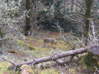
As we stood on a dune looking at the shipwreck we saw people driving on the beach. Of course Ken got excited. Next we are looking for the access road and off we went. The beach is hard sand and great fun. This will be the Last Hurrah for the HHR as it's days are numbered now! After playing we drove to the North Jetty at the river entrance. We meandered down the road through the forest when a coyote ran in front of us. We watched him hunt for a while and then he sauntered off. We arrived at the jetty parking area and took the trail to a wildlife bunker (for birders). We walked the beach to Adams Point. A huge ship was being escorted into the river by a US Coast Guard boat and helocopter. The helocopter was lowering me onto the ships deck. We wondered what was going on...

Now it's time to head home. As you've probably guessed this place is all about the River!

At home we relaxed and then went to bed. This was a really good day!

Pictures: (left to right) USCG Life Saving Exhibit, Pilot Boat on the bar (2-from film), Ship crossing the bar (from film), Capt Ken on the bridge, Astoria Bridge from Coxcomb Hill, Astoria Column, Ft Clatsop, Peter Iredale Wreck, HHR driving the beach, Coyote in Ft Stevens Park, Walking Adams Point, Tanker with USCG escort - spot under helocopter is a person...)

Sunday, April 4, 2010

Finders Keepers...

Happy Easter!

We spent most of the morning inside just relaxing, doing mail, and watching the waves. I think we both needed a quiet day. A lot of the other RV's left this morning and we are pretty much the only ones here.

Later in the afternoon we took a ride about 15 miles north on 101 to Lincoln City. At first look Lincoln City seems a bit honky-tonk, with restaurants, salt-water taffy stands, and outlet shops. This is a larger beach town and really has a lot to offer. It's "a great place to try new things". We had hoped to go to a studio where we could blow our own glass floats. Unfortunately they wanted $65 each to do this so we decided to pass.

Lincoln City has favorable winds for kite flying and takes advantage of it through annual summer and fall kite festivals. In March the city hosts an 'indoor' windless kite festival. Unfortunately the wind is still too strong and we missed the indoor festival by a week....oh well....next.

We drove through Main Street and enjoyed shops and a number of art galleries. Lincoln City has become a center for glass art. Each year from mid-October through May 30 more than 2000 signed, numbered, and handcrafted glass floats are hidden along 7.5 miles of public beach. They hide 65 floats a week (a few each day) ocean permitting. This started in 1999 for the mellenium and is kicked off by the Finders Keepers Festival each October. It is a reminder of the history of finding Japanese glass fishing floats on the beach - some of which floated in the pacific for more than 30 years. A Japanese float is rare now, but a mellenium float is much more common. Due to the storm we didn't have a chance to hunt.

Lincoln City runs along the coast from Siletz Bay past Devils Lake on the north. We drove over D River, which connects Devils Lake and the Pacific Ocean. The river is listed in Guinness Book of Records as the world's shortest river at 120 feet.

Turning back into town we took the back roads along the beach and was surprised to find the Chinook Winds Casino. With beautiful ocean views we grabbed a bite to eat and then played for a while and then headed home.

It was a good day...

Saturday, April 3, 2010

A Real Nor'Wester.....


Today we decided to check out the scenic views in the area. The storm is raging, windy, and heavy rain. Our first stop down Rte 101 S was Boiler Bay. The ocean waves roll and crash in various directions making the water look like its boiling. The waves were about 8 - 10 feet high and the spray was coming up over the rocks in huge sprays. The only word to describe it would be "tumultuous".

Further south toward Newport we took the Otter Crest Loop (part of old 101). We stopped at several overlooks to marvel at the changing views and the power and force of the sea. The Otter Crest Wayside sits 453 feet above the ocean on Cape Foulweather (perfect name). This is a great place for whale watching. We stood on the cliff edge where we could see Yaquina Head Lighthouse in the distance. A plaque at the wayside told us winds could exceed 100 mph.

Down the road, past the swirling water of Devil's Punch Bowl overlook and on to Yaquina Head Light Natural Area. The first stop is at the visitor center where we watched videos about the building of the light and the keepers who kept it going. Yaquina Head is a thin coastal headland which extends 1 mile into the ocean. It was formed by ancient lava flows. It's a great place to explore tidepools, trails, and the tallest lighthouse on the Oregon coast at 162 feet above sea level. You could spend the whole day here. The light at Yaquina Head was first illuminated in August 1873. We pulled into the lighthouse parking lot and grabbed the camera, however, when we got out the wind was so strong we could hardly stand up....oh well back into the car...

Further down 101S to the little beach town of Nye Beach. After browsing the neighborhood's boutiques and book stores we found The Chowder Bowl on a side street. Naturally clam chowder was Ken's choice while I chose fish tacos for lunch. The chowder was the best we've had so far out here. It was excellent and Angie, our waitress, was fun. Now that we're fed and happy we left for Newport Bayfront.

The Bayfront area is home to Oregon's biggest commercial fishing fleet. Sea lions also inhabit the many private docks and public piers. We could hear them barking blocks away.
Walking the boardwalk we learned about Newport's first tourist destination resort, the Ocean House, which was built in 1866. Sam Case, its proprietor, named the Ocean House for a resort in Newport, Rhode Island. It’s no surprise that Case also named Newport for his favorite town in Rhode Island.

Development of a large seafood industry didn’t begin until 1908, when electricity (needed for refrigeration) became available. This industry still thrives today. Yaquina Bay became an attractive shipping port with the construction and dredging of the jetty, complimented by Newport's famous lighthouse.

Newport was once the location of the world’s largest spruce mill which provided spruce for the manufacture of airplanes during World War I. Later the mill provided all of the wood to build Howard hughes’ infamous Spruce Goose.

Our last stop was back in Depoe Bay to visit the world's smallest navigable harbor. Today was quiet, but in the summer this little place really buzzes. Walking along the harbor we found the Kite Shop. We went in and got a beginner kite set up. Now we just need to have the wind calm down a little.

With all of our stops checked off for the day we headed back to camp. We got some great pictures today and saw fantastic scenery.


Pictures: (right to left) Boiler Bay (2), Otter Crest Overlook, Cape Foulweather (2), Yaquina Head Light, Chowder Bowl Lunch, Sea Lions

Friday, April 2, 2010

Wonderful Sea Life


Leaving Winchester Bay this morning we are going to inch our way up Rte 101N a short way to Depoe Bay. The wind was so strong we debated as to whether we should leave or not... but in the next half hour it calmed down a little. We rolled up the coast highway saying goodbye to the communities we enjoyed over the last few days. There are over 100 state parks along the coast and they are really beautiful. Many allow camping and all of them have terrific day use facilities.

Crossing over the Suislaw River the road skirts the coastline, hugging the beaches, and then climbing up cliffs to look out over rolling breakers and then winding down again. The angry ocean today is full of white caps as far as we can see. We meander through Yachats known as the "gem of the Oregon coast" with 635 villagers located at the mouth of the Yachats River. This is a vacation destination, perfect for those who enjoy quirky art festivals and music festivals throughout the summer.
Next was the community of Waldport huddled between the ocean and the Siuslaw National Forest. A very quaint little place with lots of brightly painted buildings. (They love bright yellow here...) We stopped for gas and learned that in Oregon it's a state law that the attendant has to pump your gas. Felt like we were back in the "old" days.... Our friend at the gas station told us we could get 80 mph winds later today! Looks like we are going to be able to experience a real "northwester".

A few minutes in the car brought us to Depoe Bay where we found the Sea and Sand RV Park which sits up on a bluff. There are 3 tiers of RV sites and we have a perfect view of the ocean. We got set up, but didn't put the slides out tonight... the wind is really rocking us and the gusts feel longer than 40 mph. Once settled we walked along the RV Park walkway along the bluff.

After a while we left camp and stopped to watch the waves throw water onto Main Street in Depoe Bay. There are lots of people parked along the sea wall watching the water come over the wall. With this storm and the high tide the waves are awesome, atleast 10 feet.

Further south on Rte 101 is the town of Newport and home of the Oregon Coast Aquarium. It's a fun place. As we arrived they were feeding the Sea Otters (which are huge) some very large clams, then we moved on to see the seals and Octopus. They had a great exhibit about the creatures that live in the sand and rocks. We got to touch a red Sea Star and green Anemone (sticky on the side) and you can hardly feel their tentacles. We learned a lot about the tide pools they live in. We walked through an aquarium as many different types of sharks swam over our heads and beside us as we sat along the glass. It was great. Other aquariums held sea life we had never seen before like Sea Nettles and white Jelly Fish. The aquarium was a lot of fun. After our visit we'll be much more prepared to explore tidal pools.
We had hale again on the way home. The sky is a strange looking dark gray with sunshine holes and patches of blue sky. It's beautiful, but ominous looking. We had another great day.....


Pictures: Depoe Bay RV Site, Sea Wall on Main St, Sea Otter floating on his back having dinner, Puffin, Sea Nettles, Green Anemone & Sea Stars


Thursday, April 1, 2010

OOOOOOOH!!


This morning we decided to head back to the Dean Creek Elk Viewing area to see if we could get a closer picture of the elk. We stopped at a pull off where we found 2 herds grazing close to the road. While we were watching the elk another couple joined us. They were local people and we talked with them for a while.

Next we drove up 101 back to Florence to visit the famous Oregon Dunes. The coastal range has been rising for millions of years. The dunes have been pushed upward by the incredible force of colliding tectonic plates. Wind and rain grind river rocks into sand which is deposited on ocean shores. Strong tides and winds from the pacific blow the sand into undulating ridges along the 50 miles of beach from Florence to Coos Bay. The dunes bring to mind images of Lawrence of Arabia.

Today we'll do something we've never done.. we're going Sand Railing on the dunes! Sand Dunes Frontier was our destination. The Sand Rail soon pulled up with our driver Darren, who has been driving the dunes for 19 years. We suited up in our rain jackest with hoods up, goggles, and Darren belted us into our buggy. He asked if we wanted the "fun" ride - we said "of course!" Off we went and for the next half hour we went up and over 100-200 ft dunes, down sheer drop offs like a roller coaster, back up and then along the edge until we swooped down again. We stopped at the top of a 300 ft plus dune, the tallest dune in the recreation area to take pictures. Sprinkled among the dunes are tree islands. These are remnants of larger forests that were covered by sand. These isolated stands look like they're floating in a sea of sand. It was spectacular looking over the crests to the ocean. Then we were off again curling up dunes at a 45 degree angle and then back down again. We plunged down another dune nose first causing us both to go "oooooh"! What a blast - one of the best things we've done so far on the trip.

Back at the car - a little sandy - we drove north of Florence to Hecta Light. The road passed through a tunnel that took us through a granite rock outcropping before arriving at the turnoff for Hecta Head. The light sits on the 1,000 foot high Hecta Head, 205 feet above the ocean. This light is rated the strongest on the Oregon coast and can be seen from 21 miles off shore. We walked the path from the parking lot to the lighthouse high on a cliff and watched the waves break against the rocks and headlands below. They were phenominal spraying everywhere. This lighthouse is famous and you've probably seen it on calendars.

We headed back to camp. It was a beautiful day and we had lots of fun!

Pictures: Elk, View of Oregon Dunes Recreation Area, Our Sand Rail, Sitting on Top of Dune, Sand Railing, Trail to Hecta Light, Lighthouse from Keepers home, Hecta Light, Us on the Hecta Headlands, Evening Light on Hecta Head

Wednesday, March 31, 2010

Umpqua River Scenic Byway


We had breakfast outside at the picnic table overlooking the harbor this morning. It was sunny and we haven't been able to have breakfast outside for a long time. Leaving camp we drove up Salmon Harbor Rd and took a left up a hill to Umpqua Light. The light, on the south side of the bay, has a 65 foot tower that overlooks the sand dunes from 165 feet. There was a great viewing platform and we looked over the dunes to the ocean. We looked for gray whales - none -. Leaving the Umpqua Point we passed Lake Marie and its 1 mile walking trail, we decided to keep going.

Taking 101N to Rte 38 E in Reedsport we followed the Umpqua River Scenic Byway past Dean Elk Creek Viewing Area. A three mile section of Rte 38 has two specific viewing areas with several observation pull offs. This is the year round residence for a herd of about 100 Roosevelt elk. In the spring the females and young are easily seen. The males stay separate until the fall rut. We were able to see some of the herd in a meadow just off the road.

The scenic byway is a gorgeous ride with the river on our left and fern covered rock walls to our right. Water from melting snow and all this rain cascade down the rock walls making natural waterfalls. There are farmhouses along the road on the hillsides with pastures that roll up to them. We arrived in Elkton which is a surprisingly cosmopolitan village. This historic community is where the Hudson's Bay Company founded Fort Umpqua in 1832. We had lunch in town and then continued through small vineyards and through the beautiful Umpqua Valley. Elkton is a town of about 200 people with 4 wineries (my kind of place...).

Driving through small towns like Sutherlin, Kellogg, and Remote which have great character and have kept the simple country ambience. Soon we connected to Interstate 5S and followed it to Roseburg and then turned onto Rte 42W which would take us back to Coos Bay. Rte 42 is the Winery Tour route but we didn't see many wineries along the way. Driving through the Coquille River Valley we experienced more hale showers. The pastures and low lands were flooded and cattle were standing on small patches of high ground near the barns.

We got back to camp and watched TV for a while. The drive today was really beautiful and reminds us what this trip is all about... experiencing the byways of the U.S.

Pictures: Elk in meadow at Dean Elk Creek Viewing Area, Umpqua Light, View from Umpqua Light Platform (2)

Tuesday, March 30, 2010

Salmon Harbor


Driving up the Pacific Coast Highway (101 N) through huge puddles and pea size hale. We cross over the Conde McCullough Memorial Bridge which is frozen and covered with hale - argh - Once across the bridge we come into Oregon Dunes National Recreation Area. The dunes start right after we cross the bridge and is mixed with forests and beautiful views. We pass Clear Lake and roads such as Foggy Height (very appropriate) on our way to Winchester Bay.

Our drive was short this morning and we pulled into Winchester Bay RV in early afternoon. We picked a nice site on the Salmon Harbor side of the park. We can see the boats and lights from Winchester Bay across the harbor. The ocean is on the back side of the park and we can hear the waves crashing against the sea wall (best of both worlds!). It all began in Winchester Bay, long before Europeans came to the Oregon coast, the mouth of the Umpqua River was home to ancestors of the Siuslaw, Lower Umpqua, and Coos Indians. First interaction with the Indians came in the 16th century and by the end of the 18th century trading had been established. Winchester Bay was initially a trading post known as West Umpqua. Later in the 1950's Salmon Harbor was developed to protect Winchester Bay from the Pacific Ocean. Winchester Bay is popular due to it's outdoor activities, great seafood restaurants, and access to the tallest coastal dunes in North America.

Once we were settled in we drove up Rte 101 to Florence. It's raining but we decided to go to Old Town located on the Siuslaw River. Parking on the gravel main street we found Mo's. This is a well known seafood restaurant in the area and came highly recommended by someone we met in Coos Bay. They are well known for their "New England Clam Chowder". We are going to hunt for the best Northwest Clam Chowder...Ken had Slumgullion (chowder with shrimp) and I had oyster stew. The stew was good the chowder...well lots of potatoes. We walked Old Town which is full of canneries, fish processing plants, shops and lots of restaurants. Before leaving we stopped in a candy store and spent some time talking with the owner. All of these little towns are much busier in the summer but we get to meet the real locals this time of year and they are terrific folks.

Leaving Old Town Florence we drove back to camp. Before turning into the RV park we decided to explore Salmon Harbor Rd. It runs along the ocean and ends in the beginning of the sand dunes. Many of the low areas are filled with water but there are still folks on ATV's running the trails along the dunes.

To cold and raw to be outside so we enjoyed our pate, crackers, cheese and fruit for dinner while we watched TV.
Pictures: Along Salmon Harbor Rd (2), Rainy dunes

Monday, March 29, 2010

Cape Arago Light


Coos Bay, is the largest city on the Oregon coast. We decided to take a drive out to Cape Arago Lighhouse. Newmark St takes you out of Coos Bay and through the fishing community of Charleston. The main catch here is Crab and Oysters. From Charleston, we followed signs for Cape Arago lighthouse and Sunset Bay State Park. The Simpson Reef overlook came up on our right and we pulled in.

The reef provides a small barrier to the open sea. The habitat here is one of the most important marine mammal and seabird colonies on the northwest coast. Normally the overlook provides a viewing opportunity for seals, sea lions, and many seabirds. Today there were no seals in view and the birds were all huddled amongs the crevasses in the rocks.

It's really raw and the wind will knock you over! We watched amazing waves pound against the rocky point of land across the reef. We passed the state park which was closed due to flooding from all this rain. Further down the road we found the Arago Point view. The sea is so angry. This is one Oregon lighthouse that you can't get up close to. It is protected by a locked gate maintained by the Coast Guard. The light tower is 44 ft hight and was illuminated in 1934. In terms of service this is the newest lighthouse, earlier structures were built on this site in 1866 and 1908. Both were lost due to erosion and weather.

We left the point and drove to Bastendorf Beach. The miles of uninterrupted beach and ocean views were fantastic. We followed the beach road to the end where it turned to dirt. We saw a number of cars parked next to the jetty so we decided to go see what was going on. As we pulled up a huge spray of water leaped over the jetty wall followed by a bigger spray. Getting out of the car we could see 8 ft waves roll into the jetty where it meets the bay. Soon another exploded against the wall. As the waves rolled and broke the wind, still about 35 mph, blew the water from the crest of the wave into the air.

Back in the car we headed back to camp. We had dinner at the casino tonight, played blackjack and was home by 10pm. The wind has picked up again and is really shaking us and rippling the slider awnings. We decided to bring the sliders in... we'll be glad when the wind calms down.

Pictures: Simpson Reef, Arago Point View & lighthouse in distance, Arago Point View, Bastendorf Beach Waves (2)


.


Sunday, March 28, 2010

A Wild Night

Cloudy, windy, raw and rainy...seems like that's Oregon spring weather... It was a good day to just do stuff, laundry, blogging, etc. and Ken spent the day researching what we might need if we decide to buy a Jeep.

The rain is getting harder now. We took the shuttle bus to the casino (picked us up right at our door). We played for a while and did pretty well. Back at home about 10pm the wind is really howling and shaking the coach. It must be atleast 40 mph. About midnight we got up and pulled the slides in the wind was so bad and it was raining sideways. It was a wild night!

Saturday, March 27, 2010

Coos Bay


Finally sunny and cool (45) but clear. Continuing north on the Pacific Coast Highway (Rte 101) we mosey up to Coos Bay. We are just inching our way up the Oregon coast. We passed over bridges above deep gorges with creeks running through them into the ocean.

We crossed over the Rogue River Bridge with it's picturesque concrete arches and turrets on all four corners. This bridge carries Rte 101 across the river near where it meets the Pacific. We passed pastures full of baby lambs grazing in the sun. The road moved inland for a while through farm towns like Denmark, lots of cranberry bogs, and Christmas Tree farms. The road is lined with Douglas Fir and Spruce. Arriving in Coos Bay we parked the coach near the boardwalk. Coos Bay-North Bend is the largest coastal city in Oregon. The port transport many various items but the main tonnage is made up of wood products. We sauntered along the bay and then roamed around town. Shark Bites caught our attention so we had a quick lunch.

Back in the coach we headed up the road to the Mill Casino and RV Park, which will be home for the next 3 nights. The park is right on the bay. Once we got settled in we went to check out the area and ended up looking at Jeeps, just for kicks.

Later we had dinner and watched TV. There's a very serious storm coming in with heavy rain and winds. They are saying rain for the next week! That will really hamper a lot of the things we wanted to do here.

Thanks to everyone for my birthday wishes... it was a good day.

Pictures: Rogue River Bridge, Coos Bay View from our site